


Walkable Los Angeles. Casual visitors may be surprised to learn that this is not an oxymoron.
Walkable Los Angeles. Casual visitors may be surprised to learn that this is not an oxymoron.
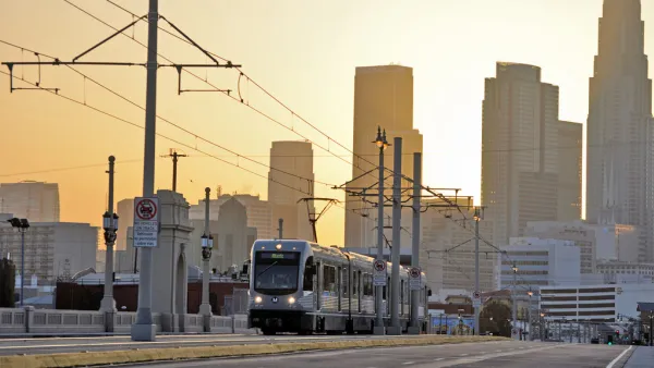
 Many LA suburbs are in fact incorporated satellite cities, built upon a classic street grid that makes them inherently walkable. These central nodes were well served by the Pacific Electric Railway until the 1930's, when the automobile began to assert itself. So it wasn't long ago that one could travel the region on foot and by rail.
Today, a No Man's Land between freeway barriers greets visitors as they drive from airport to hotel to tourist destination. This backdrop - parking lots, warehouses, strip malls - presents the city as entirely devoted to the car.
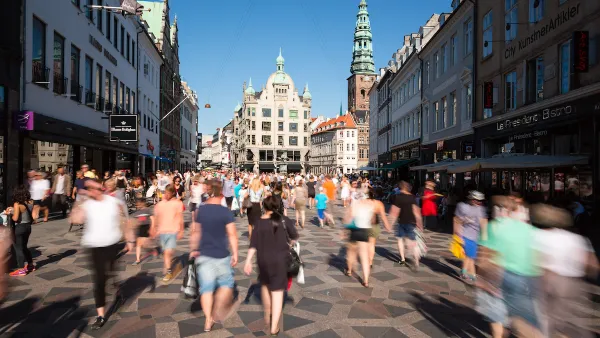
 But this impression is superficial. The older neighborhoods, rich in cultural and architectural history, remain quite walkable. Within city limits: Downtown, Hollywood, Los Feliz, and others are navigable on foot . Outside of the city, central portions of Pasadena, Santa Monica, and Long Beach are some of the most pedestrian-friendly spots anywhere.
Pasadena in particular has made great efforts to restore and maintain its urban character since it adopted a visionary General Plan in 1992 . It has directed new development to the central core while incorporating landmarks that date to the City Beautiful era (City Hall, the Civic Auditorium, the Pasadena Public Library). There are whole blocks dedicated to parks, plazas and inner courtyards that engage rather than detract from the street. Two main avenues - Colorado and Lake - now form a continuous retail corridor that is accessible from nearby residential neighborhoods. In short, Pasadena is a model for how to weave public space, retail and housing to promote walking.
 Even in pedestrian-oriented Los Angeles, roads tend to be wider and blocks tend to be larger than the ideal because traffic engineers have long tried to accommodate all of those cars circulating through the metropolis.
What's missing is transit connectivity throughout the region. Mayor Villaraigosa's 30/10 plan, which seeks federal aid to complete an ambitious transit expansion in 10 years instead of 30, makes sense because the city has already waited too long to tackle traffic congestion. The subway and light rail extensions to popular destinations on the Westside should increase ridership systemwide. The plan will also help to link LA's most walkable centers, which were designed for transit and are poised to become transit-rich communities again.
Photos:
1. Santa Monica via Google Maps
2. Old Pasadena by La Citta Vita in Planetizen's Flickr Pool
3. Pasadena City Hall

What Will the 'Third Los Angeles' Look Like?
Architecture critic Christopher Hawthorne describes an L.A. in flux, at once beholden to its postwar image and pushing in a new direction. The city, he says, faces existential questions on a scale unmatched elsewhere in the nation.
How the ‘Social Field of View’ Impacts Street Life
The vibrancy of a neighborhood may be defined by what people can see in their immediate vicinity.
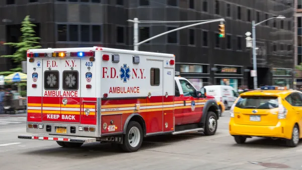
Ambulances vs. Pedestrians
Are the needs of emergency response vehicles inconsistent with nondrivers’ needs for slower, safer streets? Maybe not.

National Parks Layoffs Will Cause Communities to Lose Billions
Thousands of essential park workers were laid off this week, just before the busy spring break season.

Retro-silient?: America’s First “Eco-burb,” The Woodlands Turns 50
A master-planned community north of Houston offers lessons on green infrastructure and resilient design, but falls short of its founder’s lofty affordability and walkability goals.

Delivering for America Plan Will Downgrade Mail Service in at Least 49.5 Percent of Zip Codes
Republican and Democrat lawmakers criticize the plan for its disproportionate negative impact on rural communities.

Test News Post 1
This is a summary

Test News Headline 46
Test for the image on the front page.

Balancing Bombs and Butterflies: How the National Guard Protects a Rare Species
The National Guard at Fort Indiantown Gap uses GIS technology and land management strategies to balance military training with conservation efforts, ensuring the survival of the rare eastern regal fritillary butterfly.
Urban Design for Planners 1: Software Tools
This six-course series explores essential urban design concepts using open source software and equips planners with the tools they need to participate fully in the urban design process.
Planning for Universal Design
Learn the tools for implementing Universal Design in planning regulations.
EMC Planning Group, Inc.
Planetizen
Planetizen
Mpact (formerly Rail~Volution)
Great Falls Development Authority, Inc.
HUDs Office of Policy Development and Research
NYU Wagner Graduate School of Public Service