


With high development occurring in India, new mapping technologies can greatly help smart growth in the burgeoning country.
"This evolution in mapping has the potential to influence a much more significant and democratic process of urban design. Municipal agencies could collaborate with design professionals in establishing a simple and transparent process of uploading all upcoming urban design proposals onto dedicated websites.
Using satellite maps of Indian cities as a base, and layering proposed civic projects–new transport links, restoration and conservation of historic neighborhoods, landscape proposals for parks, changes in land use and zoning–over them, would enable a deeper understanding of the planning process. If coordinated efficiently among various stakeholders, this evolving documentation might reduce the redundancy of successive excavations of the same streets by the plethora of civic agencies."
FULL STORY: Urban Journal: Mapping the City

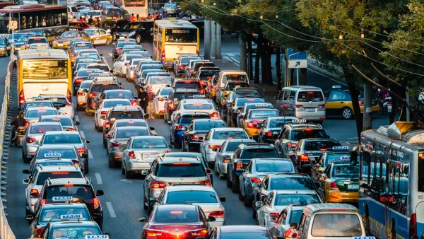
Cities Have Tried to Rein in Cars, and the Results Have Been Mixed
Vehicle pollution is making cities around the world unlivable. Some cities have taken steps to curb auto use and emissions, with varying levels of success.
Visualizing Worst-Case Scenario Sea Level Rise on the Texas Coast
Much of the state political leadership in Texas has been slow to accept the existence of climate change, much less the role of the state's economy, land use, and infrastructure planning in exacerbating the crisis. Maybe this will help wake them up?
Smog So Bad United Airlines Won't Fly There
It's not the poor visibility but the air quality, ten times worse than Beijing, that has caused the airline to stop flying to New Delhi.

Analysis: Cybertruck Fatality Rate Far Exceeds That of Ford Pinto
The Tesla Cybertruck was recalled seven times last year.

National Parks Layoffs Will Cause Communities to Lose Billions
Thousands of essential park workers were laid off this week, just before the busy spring break season.

Retro-silient?: America’s First “Eco-burb,” The Woodlands Turns 50
A master-planned community north of Houston offers lessons on green infrastructure and resilient design, but falls short of its founder’s lofty affordability and walkability goals.

Test News Post 1
This is a summary

Analysis: Cybertruck Fatality Rate Far Exceeds That of Ford Pinto
The Tesla Cybertruck was recalled seven times last year.

Test News Headline 46
Test for the image on the front page.
Urban Design for Planners 1: Software Tools
This six-course series explores essential urban design concepts using open source software and equips planners with the tools they need to participate fully in the urban design process.
Planning for Universal Design
Learn the tools for implementing Universal Design in planning regulations.
EMC Planning Group, Inc.
Planetizen
Planetizen
Mpact (formerly Rail~Volution)
Great Falls Development Authority, Inc.
HUDs Office of Policy Development and Research
NYU Wagner Graduate School of Public Service