


The editor of the Antarctic Sun says that while Antarctica has always been viewable in Google Maps, the imagery was "about as sharp as the graphics in Pong." The folks at the Polar Geospatial Center came to the rescue.
The Polar Geospatial Center, a project of the University of Minnesota, has updated almost 1,000,000 square kilometers of imagery for both poles, reports Peter Rejcek:
"The informal partnership took shape about a year ago, facilitated by a Google employee on sabbatical who worked a summer season at the South Pole Station's External U.S. government site computer help desk.
[Team leader Paul] Morin and his team of mostly students provide Google with a list of Antarctic regions - from the ice-free McMurdo Dry Valleys External U.S. government site to ice shelves to subantarctic islands - that are scientifically and logistically important."
FULL STORY: Antarctica on Google


Fighting Forest Pests With AI: A Hemlock Success Story
Fairfax County utilized GeoAI and ArcGIS technology to efficiently map and protect its hemlock trees from the invasive woolly adelgid, ensuring targeted pest management and preservation of its evergreen canopy.
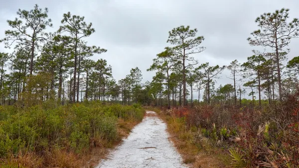
Harnessing GIS and Fire for Longleaf Pine Conservation
Scientists in Florida are using GIS technology to strategically manage prescribed burns, aiding in the restoration and biodiversity of longleaf pine ecosystems while enhancing climate resilience across the Southeast.

New Book Shows How Geographic Technology Tackles Global Challenges
In his new book, Jack Dangermond explores the transformative impact of GIS technology in solving global challenges through spatial data, highlighting its widespread application across sectors and its potential to design sustainable futures.

Analysis: Cybertruck Fatality Rate Far Exceeds That of Ford Pinto
The Tesla Cybertruck was recalled seven times last year.

National Parks Layoffs Will Cause Communities to Lose Billions
Thousands of essential park workers were laid off this week, just before the busy spring break season.

Retro-silient?: America’s First “Eco-burb,” The Woodlands Turns 50
A master-planned community north of Houston offers lessons on green infrastructure and resilient design, but falls short of its founder’s lofty affordability and walkability goals.

Test News Post 1
This is a summary

Analysis: Cybertruck Fatality Rate Far Exceeds That of Ford Pinto
The Tesla Cybertruck was recalled seven times last year.

Test News Headline 46
Test for the image on the front page.
Urban Design for Planners 1: Software Tools
This six-course series explores essential urban design concepts using open source software and equips planners with the tools they need to participate fully in the urban design process.
Planning for Universal Design
Learn the tools for implementing Universal Design in planning regulations.
EMC Planning Group, Inc.
Planetizen
Planetizen
Mpact (formerly Rail~Volution)
Great Falls Development Authority, Inc.
HUDs Office of Policy Development and Research
NYU Wagner Graduate School of Public Service