


I had heard of “dense sprawl” and “density without walkability” in the past, but before spending a week in Jerusalem last month, I had never really lived through these problems. My parents (who I was staying with) rented a unit in a high-rise condo complex called Holyland Tower. Although Holyland Tower was the tallest building in the area, there were numerous mid-rise buildings, and lots of two-and three-story apartment and condo buildings. While walking through the idea, I saw nothing resembling a single-family home. In sum, this area was a pretty dense neighborhood in a pretty dense city (Jerusalem’s overall density is roughly comparable to that of the city of San Francisco).

I had heard of "dense sprawl" and "density without
walkability" in the past, but before spending a week in Jerusalem last month, I had never really
lived through these problems.
My parents (who I was staying with) rented a unit in a
high-rise condo complex called Holyland
Tower. Although Holyland Tower
was the tallest building in the area, there were numerous mid-rise buildings,
and lots of two-and three-story apartment and condo buildings. While walking through the idea, I saw nothing
resembling a single-family home. In sum,
this area was a pretty dense neighborhood in a pretty dense city (Jerusalem's overall density is roughly comparable to that
of the city of San Francisco).
But although the density supported walking, the design did
not. To find the area, go to Google Maps
(maps.google.com) and go to a street called Avraham Perrera. You will note that the street is in a section
of looped streets that make the typical American cul-de-sac seem like a
masterpiece of clarity. As a result,
very little of interest is within walking distance, and what is within walking
distance is hard to find unless you know the area really, really, really well.
For example, the nearest restaurant is less than ¼ of a mile
away as the crow flies, but is about two miles away in reality. To get there, you have to go on five separate
streets. (To try it yourself, go to
Google Maps and ask for directions from Avraham Perrera to 5 Hose San Martin).
Because the succession of street loops is so confusing, even
places that are actually not very far are hard to find. For example, after I was in Jerusalem for a week I
discovered that there was in fact a small supermarket a ten or fifteen minute walk
away, but because of the messy street design (and admittedly, the rough terrain
as well) we were unaware of its existence.
By contrast, in a neighborhood with enough of a grid to distinguish
commercial from residential streets, commercial destinations are easy to
find. Admittedly, grids are more
difficult on hilly terrain such as that of Jerusalem.
But some American neighborhoods manage to combine walkability and hilly
terrain- for example, most of San Francisco, as
well as Philadelphia's
Manayunk.
So what my Jerusalem
neighborhood taught me was that with sufficiently poor street design, even a
fairly compact neighborhood may be more confusing to navigate, and separate
uses more aggressively, than some sprawling suburbs.


Rethinking Suburban Development: New Trends in Creating Livable Communities
Discover new trends in suburban development focused on creating more livable, sustainable communities for future growth.

Opinion: “New Towns” Are the Answer to Affordable Housing Challenges
How thoughtful design can create more walkable, livable communities.
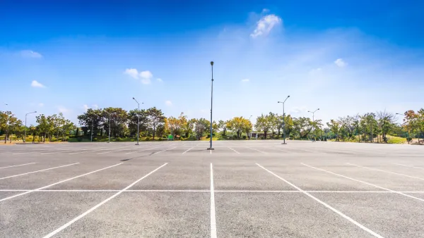
Dallas Considers Nixing Parking Requirements
According to one local official, Dallas projects routinely build 20 to 30 percent more parking than they need, driving up the cost of housing and leading to unsustainable land use patterns.

National Parks Layoffs Will Cause Communities to Lose Billions
Thousands of essential park workers were laid off this week, just before the busy spring break season.

Retro-silient?: America’s First “Eco-burb,” The Woodlands Turns 50
A master-planned community north of Houston offers lessons on green infrastructure and resilient design, but falls short of its founder’s lofty affordability and walkability goals.

Delivering for America Plan Will Downgrade Mail Service in at Least 49.5 Percent of Zip Codes
Republican and Democrat lawmakers criticize the plan for its disproportionate negative impact on rural communities.

Test News Post 1
This is a summary

Test News Headline 46
Test for the image on the front page.

Balancing Bombs and Butterflies: How the National Guard Protects a Rare Species
The National Guard at Fort Indiantown Gap uses GIS technology and land management strategies to balance military training with conservation efforts, ensuring the survival of the rare eastern regal fritillary butterfly.
Urban Design for Planners 1: Software Tools
This six-course series explores essential urban design concepts using open source software and equips planners with the tools they need to participate fully in the urban design process.
Planning for Universal Design
Learn the tools for implementing Universal Design in planning regulations.
EMC Planning Group, Inc.
Planetizen
Planetizen
Mpact (formerly Rail~Volution)
Great Falls Development Authority, Inc.
HUDs Office of Policy Development and Research
NYU Wagner Graduate School of Public Service