


The New York Times' architecture critic, Michael Kimmelman, reviews a new exhibition exploring the history of the city's grid and streets.
"After all, before it could rise into the sky, Manhattan had to create the streets, avenues and blocks that support the skyscrapers. The grid was big government in action, a commercially minded boon to private development and, almost despite itself, a creative template. With 21st-century problems - environmental, technological, economic and social - now demanding aggressive and socially responsible leadership, the exhibition is a kind of object lesson.
Simeon De Witt, Gouverneur Morris and John Rutherfurd were entrusted with planning the city back in 1811. New York huddled mostly south of Canal Street, but it was booming, its population having tripled to 96,373 since 1790 thanks to the growing port. Civic boosters predicted that 400,000 people would live in the city by 1860. They turned out to be half-right. New York topped 800,000 before the Civil War.
The planners proposed a grid for this future city stretching northward from roughly Houston Street to 155th Street in the faraway heights of Harlem. It was in many respects a heartless plan. There were virtually no parks or plazas. The presumption was that people would gravitate east and west along the numbered streets to the rivers when they wanted open space and fresh air, and not spend lots of time moving north or south. That partly explains why there were only a dozen avenues."
The exhibit, The Greatest Grid: The Master Plan of Manhattan, 1811-2011, is currently showing at the Museum of the City of New York.
Thanks to Nate Berg
FULL STORY: The Grid at 200: Lines That Shaped Manhattan

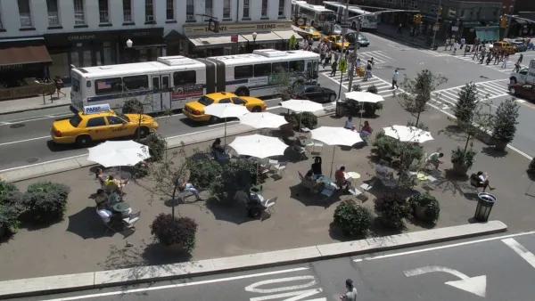
Embracing the Future of City Streets
Streets will have to evolve, again.

A Grid Balancing Act for Vibrant, Varied, and Sustainable Places
An analysis of three essential attributes of urban grids reveals a preferred layout for the desired effect of a vibrant, active community.
New York's Streets Provide "Platform for Social Activism"
Justin Davidson ruminates on the great strides Janette Sadik-Khan and New York's Department of Transportation have made in reforming the city's streets. As much as they've accomplished, the transformation remains a work in progress.

Analysis: Cybertruck Fatality Rate Far Exceeds That of Ford Pinto
The Tesla Cybertruck was recalled seven times last year.

National Parks Layoffs Will Cause Communities to Lose Billions
Thousands of essential park workers were laid off this week, just before the busy spring break season.

Retro-silient?: America’s First “Eco-burb,” The Woodlands Turns 50
A master-planned community north of Houston offers lessons on green infrastructure and resilient design, but falls short of its founder’s lofty affordability and walkability goals.

Test News Post 1
This is a summary

Analysis: Cybertruck Fatality Rate Far Exceeds That of Ford Pinto
The Tesla Cybertruck was recalled seven times last year.

Test News Headline 46
Test for the image on the front page.
Urban Design for Planners 1: Software Tools
This six-course series explores essential urban design concepts using open source software and equips planners with the tools they need to participate fully in the urban design process.
Planning for Universal Design
Learn the tools for implementing Universal Design in planning regulations.
EMC Planning Group, Inc.
Planetizen
Planetizen
Mpact (formerly Rail~Volution)
Great Falls Development Authority, Inc.
HUDs Office of Policy Development and Research
NYU Wagner Graduate School of Public Service