


The Environmental Protection Agency is crowdsourcing a massive photo project to update a 40-year old agency project known as 'Documerica', which includes images of American environmental problems and everyday life.
"Challenges from US government agencies are all the rage these days and the Environmental Protection Agency today became the latest group to issue one: Take cool pictures of your surrounding environment to become part of historical record," writes Michael Cooney.
The EPA asks the public to "Choose an original Documerica photo either from the ones we post for each challenge or one you find yourself. Go to the location where that Documerica photo was taken, possibly even the exact spot where that photographer stood to take the photo 40-odd years ago, and 're-take' a current photo of the same scene. Read more about the photo on Flickr, for additional clues about location or subject matter that might help you. If the challenge includes more than one Documerica photo, choose one or as many as you like. The EPA will select photos that best show the new 'after' view of the same original 'before' Documerica photo."
For the Documerica Project (1971-1977), the Environmental Protection Agency (EPA) hired freelance photographers to capture images relating to environmental problems, EPA activities, and everyday life in the 1970s. Photos can be found on Flickr.
FULL STORY: Previous Article Next Article EPA wants your environment pictures, issues public photo challenge

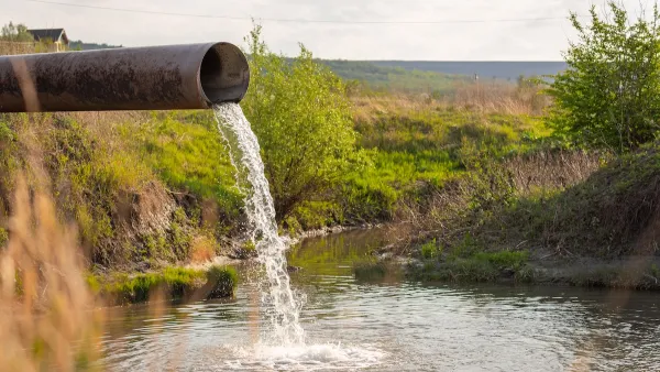
Supreme Court Could Curb EPA’s Water Quality Regulation Powers
A suit brought by the city of San Francisco argues that the agency’s language around water treatment and discharge is too vague and imposes retroactive penalties.
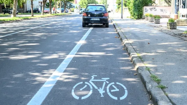
New App Pays Users to Report Illegally Parked Cars
A Swedish company is leveraging the power of crowdsourcing and the gig economy to enforce parking laws.

EPA Releases Equity Action Plan
The agency is taking a more holistic approach to addressing environmental justice concerns.

National Parks Layoffs Will Cause Communities to Lose Billions
Thousands of essential park workers were laid off this week, just before the busy spring break season.

Retro-silient?: America’s First “Eco-burb,” The Woodlands Turns 50
A master-planned community north of Houston offers lessons on green infrastructure and resilient design, but falls short of its founder’s lofty affordability and walkability goals.

Delivering for America Plan Will Downgrade Mail Service in at Least 49.5 Percent of Zip Codes
Republican and Democrat lawmakers criticize the plan for its disproportionate negative impact on rural communities.

Test News Post 1
This is a summary

Test News Headline 46
Test for the image on the front page.

Balancing Bombs and Butterflies: How the National Guard Protects a Rare Species
The National Guard at Fort Indiantown Gap uses GIS technology and land management strategies to balance military training with conservation efforts, ensuring the survival of the rare eastern regal fritillary butterfly.
Urban Design for Planners 1: Software Tools
This six-course series explores essential urban design concepts using open source software and equips planners with the tools they need to participate fully in the urban design process.
Planning for Universal Design
Learn the tools for implementing Universal Design in planning regulations.
EMC Planning Group, Inc.
Planetizen
Planetizen
Mpact (formerly Rail~Volution)
Great Falls Development Authority, Inc.
HUDs Office of Policy Development and Research
NYU Wagner Graduate School of Public Service