


With strong advocates in Washington and in City Hall, planning continues for an ambitious multi-billion dollar effort to overhaul the Los Angeles River and its relationship to the city.
Writing in the January issue of Planning, ahead of the American Planning Association's annual conference to be held in Los Angeles this April, Lorelei Laird provides an overview and update of the status of plans to turn what many consider an oversized drainage ditch into a recreational hub, ecological asset, and an engine for economic development.
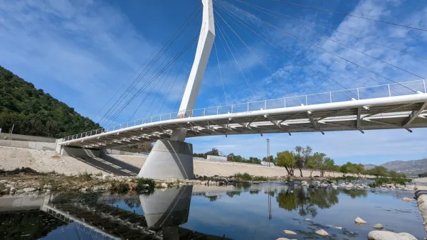
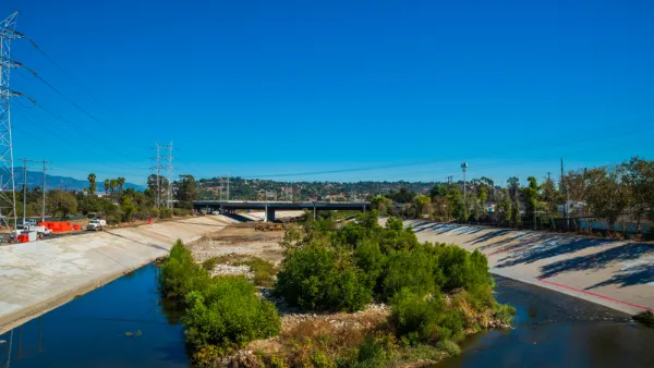
Ecological restoration "calls for removing at least some concrete. Compromises include restoring a soft bottom in some areas, creating stepped terraces along the banks, and removal of the concrete sides in a few places where floodplains can be created safely."
In a city that the Trust for Public Land says has 6.2 acres of park space per 1,000 residents currently, "planners envision parkland extending at least 250 feet from each bank, with walkways, a bicycle path, a few equestrian paths, and public art. But the plan doesn't end at the river's edge. In most areas, this 32-mile greenbelt is connected with existing destinations like parks, schools, neighborhoods, and businesses, using dedicated car-free paths and existing streets dressed up with river signage."
"The economic development portion of the plan starts from the belief that all these improvements will increase private development, a lesson drawn from redevelopment projects in many other cities. It expects that riverfront activity would draw businesses catering to park users, such as cafes, hotels, and other entertainment destinations. Overall, planners predict that every public dollar will attract four private redevelopment dollars, creating billions of dollars' worth of new development around the river."
FULL STORY: Restoring the 'Water Freeway'


Gehry's Plans for Los Angeles River Restoration Gaining Clarity
Details are emerging in the controversial effort by Gehry Partners, LLP to plan a new vision for the Los Angeles River. So far, however, Gehry Partners seems to have been listening more than plotting or drawing.
A New Master Plan for the Los Angeles River
The L.A. County Board of Supervisors voted to approved a new master plan for the L.A. River—the “Reimagined River.”
A Comment for the L.A. River Master Plan
Five themes proposed to achieve justice and sustainability for the Los Angeles River and its surrounding communities.

National Parks Layoffs Will Cause Communities to Lose Billions
Thousands of essential park workers were laid off this week, just before the busy spring break season.

Retro-silient?: America’s First “Eco-burb,” The Woodlands Turns 50
A master-planned community north of Houston offers lessons on green infrastructure and resilient design, but falls short of its founder’s lofty affordability and walkability goals.

Delivering for America Plan Will Downgrade Mail Service in at Least 49.5 Percent of Zip Codes
Republican and Democrat lawmakers criticize the plan for its disproportionate negative impact on rural communities.

Test News Post 1
This is a summary

Test News Headline 46
Test for the image on the front page.

Balancing Bombs and Butterflies: How the National Guard Protects a Rare Species
The National Guard at Fort Indiantown Gap uses GIS technology and land management strategies to balance military training with conservation efforts, ensuring the survival of the rare eastern regal fritillary butterfly.
Urban Design for Planners 1: Software Tools
This six-course series explores essential urban design concepts using open source software and equips planners with the tools they need to participate fully in the urban design process.
Planning for Universal Design
Learn the tools for implementing Universal Design in planning regulations.
EMC Planning Group, Inc.
Planetizen
Planetizen
Mpact (formerly Rail~Volution)
Great Falls Development Authority, Inc.
HUDs Office of Policy Development and Research
NYU Wagner Graduate School of Public Service