


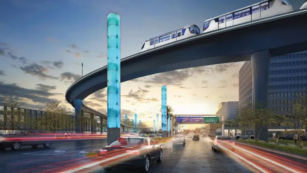
A subject that has flummoxed transit advocates and planners in L.A. for decades is how to best connect to the city's largest airport. As planning advances for billions of dollars in transit projects, Yonah Freemark explores how best to make the link.
Construction of the Green Line light rail came tantalizingly close to reaching the airport when it was completed in 1995. At the line's deceptively named Aviation station (for the boulevard), a free shuttle bus is required to complete your trip to Los Angeles International Airport (LAX).
As a result, according to Freemark, "just 1% of air passengers and 9% of employees arrive by public transportation. As a comparison, according to the most recent Census statistics, 7.1% of Los Angeles County residents take transit to work and 11.0% of Los Angeles City residents do the same. There is certainly room for improvement."
Now as planning advances for the the new Crenshaw light rail line, to be funded from the pot of money created by 2008's Measure R sales tax hike, planners are again struggling with how best to integrate the airport into the city's expanding transit network.
Freemark explores the alternatives now being considered by Metro, the transit authority, which, "has two fundamental options: Will it serve the airport directly with rapid transit service, or will it have its customers transfer to a people mover from which they will have access to terminals?"
With no easy answers and challenges on both the technical and funding sides, Freemark concludes that, "[n]one of the solutions proposed will significantly improve airport travel times for most people in the region, and none of them will get downtown within half an hour of the airport, a goal for most cities."
Clearly there's more work to be done to facilitate what may be the most important single transit connection in the city.
FULL STORY: For L.A., How to Build an Airport Rail Connection That Makes Sense for Passengers?

L.A. Breaks Ground on New Light Rail Line as Pols Debate Airport Connection
Tuesday was a day of celebration in South L.A. as officials broke ground on the 8.5-mile Crenshaw Line, the newest addition to the region's expanding transit network. But just two days later, politicians resumed bickering over how to connect to LAX.
Has L.A. Solved Its Most Important Transit Conundrum?
It's one of those news items that makes you ask: "Duh, what took you so long?" Los Angeles World Airports and the Metropolitan Transportation Authority are finally working together to identify how to connect LAX with the city's transit system.
LA City Council Approves Extra Funding for LAX People Mover
The automated electric rail system is expected to carry up to 30 million passengers per year to points in and around the Los Angeles International Airport.

National Parks Layoffs Will Cause Communities to Lose Billions
Thousands of essential park workers were laid off this week, just before the busy spring break season.

Retro-silient?: America’s First “Eco-burb,” The Woodlands Turns 50
A master-planned community north of Houston offers lessons on green infrastructure and resilient design, but falls short of its founder’s lofty affordability and walkability goals.

Delivering for America Plan Will Downgrade Mail Service in at Least 49.5 Percent of Zip Codes
Republican and Democrat lawmakers criticize the plan for its disproportionate negative impact on rural communities.

Test News Post 1
This is a summary

Test News Headline 46
Test for the image on the front page.

Balancing Bombs and Butterflies: How the National Guard Protects a Rare Species
The National Guard at Fort Indiantown Gap uses GIS technology and land management strategies to balance military training with conservation efforts, ensuring the survival of the rare eastern regal fritillary butterfly.
Urban Design for Planners 1: Software Tools
This six-course series explores essential urban design concepts using open source software and equips planners with the tools they need to participate fully in the urban design process.
Planning for Universal Design
Learn the tools for implementing Universal Design in planning regulations.
EMC Planning Group, Inc.
Planetizen
Planetizen
Mpact (formerly Rail~Volution)
Great Falls Development Authority, Inc.
HUDs Office of Policy Development and Research
NYU Wagner Graduate School of Public Service