


Ever wonder what effect the pollution you're exposed to in your neighborhood on a daily basis is having on your family's long-term health? The emerging field of geo-medecine is providing answers, reports Christine MacDonald.
MacDonald profiles the work of Bill Davenhall, a health-care manager with the geographic information systems software developer Esri, and a pioneer in the emerging, yet controversial, field of geo-medicine, which "uses GIS mapping to correlate environmental conditions to health risks like heart attacks and cancer."
Born out Davenhall's desire to find the link between the pollution he'd been exposed to throughout his life and his health troubles, his work has resulted in a free iPhone app, "to help people map their lifetime environmental exposures," and an ongoing project with Loma Linda University Medical Center, 60 miles east of Los Angeles, to geo-code patient address records, among other initiatives.
The potential of geo-medicine seems promising: "it can zoom in on a patient's life to create a geographically
enhanced medical history. Or it can zoom out to give public health
officials, city planners and activists detail-rich insights on how to
improve the well-being of entire communities."
However, not all are as optimistic about the value of geo-medicine as Davenhall. "Some doctors are skeptical. They question the value of tracking
pollutants that, say, cause lung cancer, when there is currently no
preventative screening to catch cases before symptoms appear. Other
critics expect it will lead to more lawsuits. Privacy concerns have also
been raised," writes MacDonald
FULL STORY: Mapping a Lifetime of Health Risks

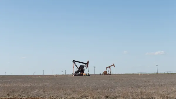
Silent Threat: America’s Abandoned Oil Wells and the Danger Beneath
Abandoned oil and gas wells across the U.S. pose significant environmental, health, and safety risks, with many leaking hazardous gases and chemicals, highlighting regulatory failures and the immense financial burden of remediation.
New Jersey to Consider Charging Fossil Fuel Companies for Pollution
A proposed law would make companies liable for damages caused by burning fossil fuels.
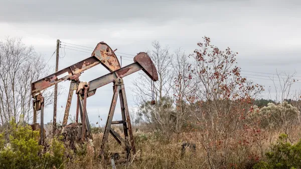
Addressing Orphan Wells for Environmental Justice
Remediating and repurposing some orphan oil and gas wells into parks can turn environmental hazards into community assets, promoting health, environmental justice, and accessible green space for underserved areas.

Analysis: Cybertruck Fatality Rate Far Exceeds That of Ford Pinto
The Tesla Cybertruck was recalled seven times last year.

National Parks Layoffs Will Cause Communities to Lose Billions
Thousands of essential park workers were laid off this week, just before the busy spring break season.

Retro-silient?: America’s First “Eco-burb,” The Woodlands Turns 50
A master-planned community north of Houston offers lessons on green infrastructure and resilient design, but falls short of its founder’s lofty affordability and walkability goals.

Test News Post 1
This is a summary

Analysis: Cybertruck Fatality Rate Far Exceeds That of Ford Pinto
The Tesla Cybertruck was recalled seven times last year.

Test News Headline 46
Test for the image on the front page.
Urban Design for Planners 1: Software Tools
This six-course series explores essential urban design concepts using open source software and equips planners with the tools they need to participate fully in the urban design process.
Planning for Universal Design
Learn the tools for implementing Universal Design in planning regulations.
EMC Planning Group, Inc.
Planetizen
Planetizen
Mpact (formerly Rail~Volution)
Great Falls Development Authority, Inc.
HUDs Office of Policy Development and Research
NYU Wagner Graduate School of Public Service