


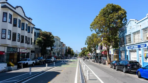
Following precedents from other cities, San Francisco is looking to redesign its famous Market Street by removing automobiles, creating raised bike lanes, implementing faster transit, and making for a more inviting public space.
Turning streets into pedestrian plazas is no novel idea. Implemented in cities worldwide to mixed results, San Francisco now looks to follow the more successful variety, by starting the planning process to change one of its most famous thoroughfares, Market Street, into a more lively public space.
Aaron Bialick, of Streetsblog reports, "[m]any of the concepts...like car-free zones, raised bike lanes, faster transit, and more inviting public spaces...are hallmarks of the world's greatest streets, and planners in the multi-agency effort are aiming to adapt them to Market using a swath of survey data about how the street is used."
Experiments with restricting automobile traffic has proven successful in other cities, like New York City's Broadway and Copenhagen's Nørrebrogade. Like these precedents, Market Street contains a high usage of bicycles and transit, with "85 percent of people on Market Street [getting] there without a car," and "a quarter of transit boardings in SF [taking] place on Market," states Bialick, citing information provided by project staff.
Obstacles remain, such as the estimated $250 million price tag, of which only the funds for re-paving the street are currently available. Still, the project hopes to be completed in 2015.
FULL STORY: Learning From Other Cities, Planners Shop Early Visions for Market Street

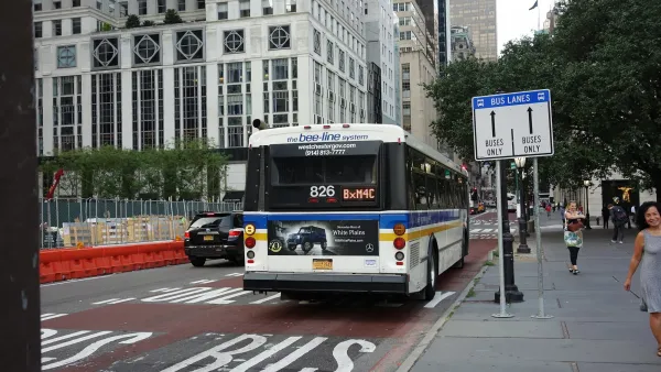
Where to Prioritize Buses Next
Advocates in New York City, San Francisco, and Seattle are pushing for more transit and pedestrian priority, and less car-centric streets, as a wave of high-profile projects capture national attention.
Construction Begins Raising San Francisco Bike Lane
A small section of the well-used, protected bike lane on San Francisco's busy Market Street will be raised just a few inches to increase bicycle safety. Construction began Monday and should take a month to complete.
How San Francisco’s ‘People Protected Bike Lanes’ are Moving the Needle on Road Safety
A local bike safety protest has become a global phenomenon.

National Parks Layoffs Will Cause Communities to Lose Billions
Thousands of essential park workers were laid off this week, just before the busy spring break season.

Retro-silient?: America’s First “Eco-burb,” The Woodlands Turns 50
A master-planned community north of Houston offers lessons on green infrastructure and resilient design, but falls short of its founder’s lofty affordability and walkability goals.

Delivering for America Plan Will Downgrade Mail Service in at Least 49.5 Percent of Zip Codes
Republican and Democrat lawmakers criticize the plan for its disproportionate negative impact on rural communities.

Test News Post 1
This is a summary

Test News Headline 46
Test for the image on the front page.

Balancing Bombs and Butterflies: How the National Guard Protects a Rare Species
The National Guard at Fort Indiantown Gap uses GIS technology and land management strategies to balance military training with conservation efforts, ensuring the survival of the rare eastern regal fritillary butterfly.
Urban Design for Planners 1: Software Tools
This six-course series explores essential urban design concepts using open source software and equips planners with the tools they need to participate fully in the urban design process.
Planning for Universal Design
Learn the tools for implementing Universal Design in planning regulations.
EMC Planning Group, Inc.
Planetizen
Planetizen
Mpact (formerly Rail~Volution)
Great Falls Development Authority, Inc.
HUDs Office of Policy Development and Research
NYU Wagner Graduate School of Public Service