


Several collaborative Google Maps cover Traditional Neighborhood Developments (TNDs) across the US and Canada as well as form-based codes globally. Are yours listed?
A number of indices measure walkability, affordability, and environmental performance, including CNT's H+T Index, Walkscore, and IMI's Walkability Index. But they may not be measuring livability quite yet. Hazel Borys invites you to add to the Collaborative Google Maps that currently track Form-Based Codes and Traditional Neighborhood Developments. Borys says:
"At the macro level, a livable project is one that embodies the CNU Charter. However, there are few metrics associated with the Charter. Many projects can look great from satellite view, as seen on the following maps: Eastern US | Western US | Canada. Turn on satellite view, zoom in, and analyze. Still, when walking down these streets, the neighborhoods have various levels of authenticity, immersiveness, and livability."
"Similarly, the SmartCode is a starting point for urban metrics, with significant changes to the numbers based on local character. On top of that discussion, you could layer on environmental impacts of TNDs. They may provide great examples of urban form, but have dismal H+T Index performance. Form-based codes (FBCs) remove barriers to entry for walkable infill and redevelopment that can deliver better housing and transportation affordability. Collaborative Google Maps are part of the Code Study: SmartCodes Adopted | SmartCodes in Progress | Other Form-Based Codes."
Thanks to Scott Doyon
FULL STORY: Collaborative Placemaking Maps

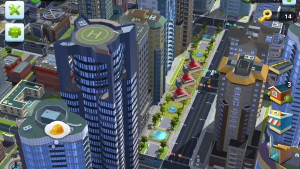
3 Good Reasons SimCity Should Adopt a Form-Based Code
And an update from Codes Study about the 600 places that really are upping their game with form-based codes.
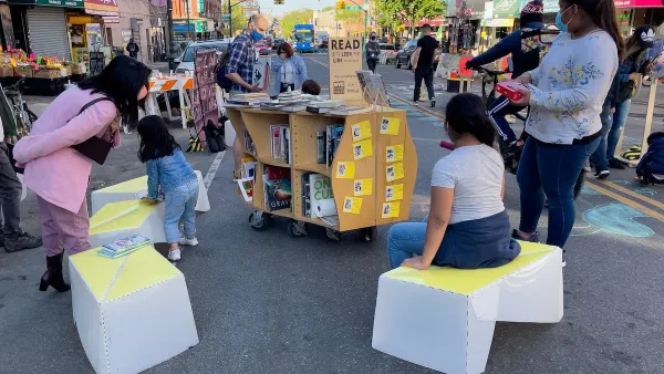
Meet NYC’s New Office of Livable Streets
The NYC DOT program will build on pandemic-era initiatives to promote safe and comfortable streets that enhance community and expand uses beyond just moving cars.

Can L.A. Accomplish Affordability with 'Housing Plus, Plus, Plus'?
Alfred Fraijo Jr., partner at Sheppard Mullin, shares frustration with what he sees as a state inaction on housing and L.A.'s legacy of piecemeal planning and outdated zoning.

Analysis: Cybertruck Fatality Rate Far Exceeds That of Ford Pinto
The Tesla Cybertruck was recalled seven times last year.

National Parks Layoffs Will Cause Communities to Lose Billions
Thousands of essential park workers were laid off this week, just before the busy spring break season.

Retro-silient?: America’s First “Eco-burb,” The Woodlands Turns 50
A master-planned community north of Houston offers lessons on green infrastructure and resilient design, but falls short of its founder’s lofty affordability and walkability goals.

Test News Post 1
This is a summary

Analysis: Cybertruck Fatality Rate Far Exceeds That of Ford Pinto
The Tesla Cybertruck was recalled seven times last year.

Test News Headline 46
Test for the image on the front page.
Urban Design for Planners 1: Software Tools
This six-course series explores essential urban design concepts using open source software and equips planners with the tools they need to participate fully in the urban design process.
Planning for Universal Design
Learn the tools for implementing Universal Design in planning regulations.
EMC Planning Group, Inc.
Planetizen
Planetizen
Mpact (formerly Rail~Volution)
Great Falls Development Authority, Inc.
HUDs Office of Policy Development and Research
NYU Wagner Graduate School of Public Service