


Alexis C. Madrigal get exclusive access to "Ground Truth," Google's project to develop the most accurate maps in the world. But why is the master of the virtual world so intent on documenting the physical world?
As Madrigal explains, Google's commitment to documenting the physical world serves two purposes. First, it fits within the company's core mission to organize all the world's information. "'If you look at the offline world, the real world in which we live, that
information is not entirely online,' Manik Gupta, the senior product
manager for Google Maps, told [Madrigal]. 'Increasingly as we go about our
lives, we are trying to bridge that gap between what we see in the real
world and [the online world], and Maps really plays that part.'"
The last item mentioned by Gupta plays into the project's second purpose: to compete with Apple over who will control the future of mobile phones. "If you're at all like
me," says Madrigal, "you use mapping more than any other application except for the
communications suite (phone, email, social networks, and text
messaging)...Whereas Apple's strengths are in product design, supply chain
management, and retail marketing, Google's most obvious realm of
competitive advantage is in information. Geo data -- and the apps built
to use it -- are where Google can win just by being Google."
What follows in the article is a fascinating peek inside the process to collect, engineer, and make operative the complex set of information hidden behind every Google Map.
"As we slip and slide into a world where our augmented reality is
increasingly visible to us off and online, Google's geographic data may
become its most valuable asset," concludes Madrigal. "Not solely because of this data alone,
but because location data makes everything else Google does and knows
more valuable."
"Or as my friend and sci-fi novelist
Robin Sloan put it to me, 'I maintain that this is Google's core asset.
In 50 years, Google will be the self-driving car company (powered by
this deep map of the world) and, oh, P.S. they still have a search
engine somewhere.'"
FULL STORY: How Google Builds Its Maps—and What It Means for the Future of Everything

How Google Maps Gets the 'Ground Truth' for Street View
A peak under the hood at "Ground Truth"—the operation behind Google Street View.

Google Maps Introduces New Transit, EV Features
It will now be easier to find electric car charging stations and transit options.
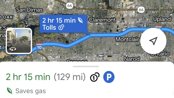
Google Maps Feature Identifies Most Fuel-Efficient Routes
A new feature highlights routes that use the least gas to help users make the most fuel-efficient driving decisions.

National Parks Layoffs Will Cause Communities to Lose Billions
Thousands of essential park workers were laid off this week, just before the busy spring break season.

Retro-silient?: America’s First “Eco-burb,” The Woodlands Turns 50
A master-planned community north of Houston offers lessons on green infrastructure and resilient design, but falls short of its founder’s lofty affordability and walkability goals.

Delivering for America Plan Will Downgrade Mail Service in at Least 49.5 Percent of Zip Codes
Republican and Democrat lawmakers criticize the plan for its disproportionate negative impact on rural communities.

Test News Post 1
This is a summary

Test News Headline 46
Test for the image on the front page.

Balancing Bombs and Butterflies: How the National Guard Protects a Rare Species
The National Guard at Fort Indiantown Gap uses GIS technology and land management strategies to balance military training with conservation efforts, ensuring the survival of the rare eastern regal fritillary butterfly.
Urban Design for Planners 1: Software Tools
This six-course series explores essential urban design concepts using open source software and equips planners with the tools they need to participate fully in the urban design process.
Planning for Universal Design
Learn the tools for implementing Universal Design in planning regulations.
EMC Planning Group, Inc.
Planetizen
Planetizen
Mpact (formerly Rail~Volution)
Great Falls Development Authority, Inc.
HUDs Office of Policy Development and Research
NYU Wagner Graduate School of Public Service