


German photographer Christoph Gielen has trained his artistic eye on America's suburbs, capturing aerial images of sprawl "in all its geometric glory" in order to "startle the viewers," reports Ariel Schwartz.
When Gielen conceived of a project to produce photographs that would cause viewers to "reconsider how they live," he didn't want to capture just any old suburb from the air. Instead, he "researched foreclosure in different states and zoomed in on those with
the highest rates," explicitly connecting his images to the unsustainable phenomenon of "suburban hypergrowth and subsequent stagnancy."
"Using map data from the U.S. Geological Survey,
Gielen was able to zoom in on suburban sprawl in individual counties," notes Schwartz. "He
visited a number of developments, trying to understand the makeup of
the communities and their selling points. In the end, he selected the
developments that he deemed most interesting for flyovers in a rented
helicopter. 'When you look at what regions had grown the fastest, which
ones were in decline, it was always Southwest Florida, the West Coast,'
says Gielen. 'Statistics is where I started.'"
"He ended with beautiful aerial photographs of sprawl in all its geometric glory," says Schwartz.
FULL STORY: The Hidden Beauty Of Suburban Sprawl


Capturing the Post-Pandemic City: The Power of 'Visual Prosecution'
Have you ever tried immersive photography to show how urban landscapes, with their ever-evolving stories, are changing post-pandemic? A three-time author of books about understanding the innate identities of urban places updates his perspective.
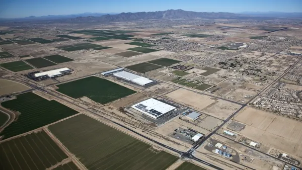
Arizona Tapping Groundwater to Fuel Suburban Growth
Critics say Arizona’s growth patterns are unsustainable and dangerous, given the depleted Colorado River and the state’s deepening reliance on groundwater.
How to Fix Racist Housing Policies: Sue the Suburbs
Strengthening U.S. Department of Housing and Urban Development's civil rights enforcement could send a powerful signal to communities resistant to changing discriminatory housing rules.

National Parks Layoffs Will Cause Communities to Lose Billions
Thousands of essential park workers were laid off this week, just before the busy spring break season.

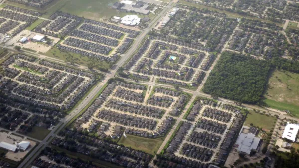
Retro-silient?: America’s First “Eco-burb,” The Woodlands Turns 50
A master-planned community north of Houston offers lessons on green infrastructure and resilient design, but falls short of its founder’s lofty affordability and walkability goals.

Delivering for America Plan Will Downgrade Mail Service in at Least 49.5 Percent of Zip Codes
Republican and Democrat lawmakers criticize the plan for its disproportionate negative impact on rural communities.

Test News Post 1
This is a summary

Test News Headline 46
Test for the image on the front page.

Balancing Bombs and Butterflies: How the National Guard Protects a Rare Species
The National Guard at Fort Indiantown Gap uses GIS technology and land management strategies to balance military training with conservation efforts, ensuring the survival of the rare eastern regal fritillary butterfly.
Urban Design for Planners 1: Software Tools
This six-course series explores essential urban design concepts using open source software and equips planners with the tools they need to participate fully in the urban design process.
Planning for Universal Design
Learn the tools for implementing Universal Design in planning regulations.
EMC Planning Group, Inc.
Planetizen
Planetizen
Mpact (formerly Rail~Volution)
Great Falls Development Authority, Inc.
HUDs Office of Policy Development and Research
NYU Wagner Graduate School of Public Service