


L.A. Times architecture critic Christopher Hawthorne reports on the changing nature of Lankershim Blvd., which appears to be at a crossroads between integrating transit into a multi-modal future or turning to outdated planning strategies.
The most vital north-south corridor in the San Fernando Valley “is emphatically on the rise” reports Hawthorne. In the latest entry in his excellent series on L.A.'s boulevards, he looks at how Lankershim Boulevard illustrates how the "hierarchy of Southern California boulevards is being reshuffled by the growth of the region's bus and rail network."
Lankershim Blvd.'s southern end, which is connected to the region's history and wealth, has benefited immensely from the arrival of the Red (subway) and Orange (rapid-bus) lines, with new pedestrian, cultural and economic activity resulting from the investment in infrastructure and redevelopment.
Now, this fledgling pedestrian and commercial activity is being threatened by “plans to build both a $22-million pedestrian tunnel to connect the Red and Orange lines in North Hollywood and a $20-million footbridge over Lankershim at the Universal City subway stop," which though reasonable enough on the surface given pedestrian safety concerns, may have an ulterior motive, he suggests. “What's driving the proposals to remove pedestrians from the boulevard is not just a concern for their safety. It's also a fear of traffic congestion along Lankershim, a worry that all those people on foot are proving an impediment to the free movement of cars.”
Hawthorne asserts that there are far simpler and cheaper solutions to the proposed plans, including: "[widening] the crosswalks, [giving] people more time to get from one side to the other, and [ticketing] drivers who fail to yield.” He also cites studies which show that drivers become more cautious as “more kinds of users crowd together along a boulevard”.
Though Hawthorne concedes that the firm behind the pedestrian bridge plan, Rios Clementi Hale, has “challenged head-on the primacy of the car in Los Angeles and opened up new space for those on foot” in other projects, he calls out the inconsistency of their approach in the Valley, which on the contrary, seems intent on “[mounting] an old-fashioned defense of car culture” “along a boulevard that is otherwise showing the dramatic benefits of an expanding transit network for sidewalk activity and economic development”.
FULL STORY: Lankershim Boulevard rides to prominence in the Valley

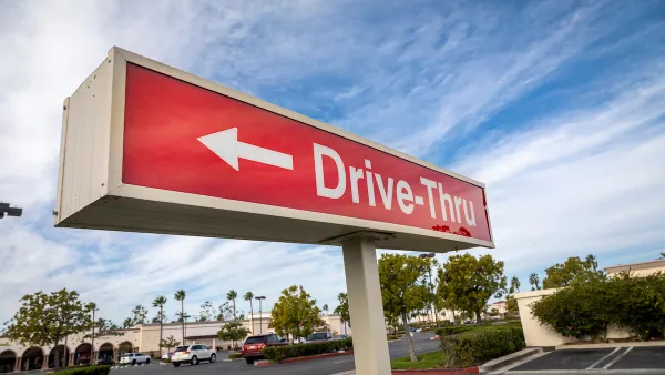
The Resurgence of Drive-Throughs
Dining areas in many fast food restaurants are being replaced with added drive-thru lanes, another post-pandemic impact on our lives benefiting those with four wheels (or more).
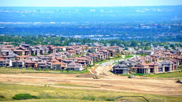
Majority of Americans Prefer Larger Homes and Longer Trips, Survey Says
The percentages have fluctuated on either side of the pandemic, but most Americans prefer to live in communities with larger houses, located farther away from schools, stores, and restaurants, according to a recent Pew Research Center survey.
Essay: Will America Ever Change its Urban Patterns?
If there has ever been a good time to change our urban patterns, the time is now.

National Parks Layoffs Will Cause Communities to Lose Billions
Thousands of essential park workers were laid off this week, just before the busy spring break season.

Retro-silient?: America’s First “Eco-burb,” The Woodlands Turns 50
A master-planned community north of Houston offers lessons on green infrastructure and resilient design, but falls short of its founder’s lofty affordability and walkability goals.

Delivering for America Plan Will Downgrade Mail Service in at Least 49.5 Percent of Zip Codes
Republican and Democrat lawmakers criticize the plan for its disproportionate negative impact on rural communities.

Test News Post 1
This is a summary

Test News Headline 46
Test for the image on the front page.

Balancing Bombs and Butterflies: How the National Guard Protects a Rare Species
The National Guard at Fort Indiantown Gap uses GIS technology and land management strategies to balance military training with conservation efforts, ensuring the survival of the rare eastern regal fritillary butterfly.
Urban Design for Planners 1: Software Tools
This six-course series explores essential urban design concepts using open source software and equips planners with the tools they need to participate fully in the urban design process.
Planning for Universal Design
Learn the tools for implementing Universal Design in planning regulations.
EMC Planning Group, Inc.
Planetizen
Planetizen
Mpact (formerly Rail~Volution)
Great Falls Development Authority, Inc.
HUDs Office of Policy Development and Research
NYU Wagner Graduate School of Public Service