


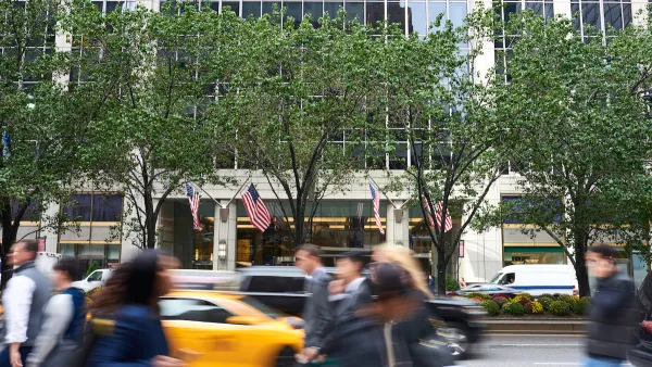
One out of ten New Yorkers gets lost every week, according to the city's Department of Transportation, and this does not include out-of-towners. In March, the city will begin installing 150 wayfinding signs to help pedestrians navigate their way.
“Whether you’re a life-long New Yorker or a first-time visitor, everyone knows the feeling of walking out of a building or a subways station and being turned around, not knowing where you are,” said Janette Sadik-Khan, Transportation Commissioner. “These maps will help everyone in the city get around.” The signs will be located at high-traffic pedestrian locations in Midtown, Chinatown, Long Island City and Prospect Heights and Western Crown Heights. A sample shows that they will include major landmarks, local businesses, and estimated transit times within a 5-minute proximity. What's innovative is that these new maps will be laser printed directly on glass, adds Matt Chaban, and they will be formatted in "'heads-up mapping,' meaning that they are oriented the way a person is looking."
The winning bid for the project comes from PentaCity, a group made up of graphic design studio Pentagram, map makers City ID and industrial designers Billings Jackson. Pentagram has collaborated with the city on other recent projects including the the LOOK safety campaign and new parking signs.
The $6 million project was funded largely by the federal Department of Transportation, and most of the rest from local business improvement districts (BIDs). Many BIDs already have their own signs, says Chaban, but "[t]he goal was to unify all the wayfinding signage, including a new font called Helvetica DOT that Pentagram designed special for the department, a throwback to the same font gracing the subways." The city believes that the signs will help people learn the city better, and Sadik-Khan said, "That's good for business, that's good for communities, that's good for everybody. People will start to mix it up, exploring new neighborhoods and even new blocks in their old neighborhoods."
FULL STORY: Lost City of New York: New Sleek DOT Signs Help Pedestrians Find Their Way

NYC Officials Split on Jaywalking Decriminalization
While some council members say the ‘outdated’ practice disproportionately impacts Black and Latino residents, law enforcement officials say its a necessary measure for road safety.

Crosswalks Near NYC Schools More Dangerous Than Average
A child and a crossing guard were killed in school crosswalks within one week as the NYPD cuts crossing guard jobs.
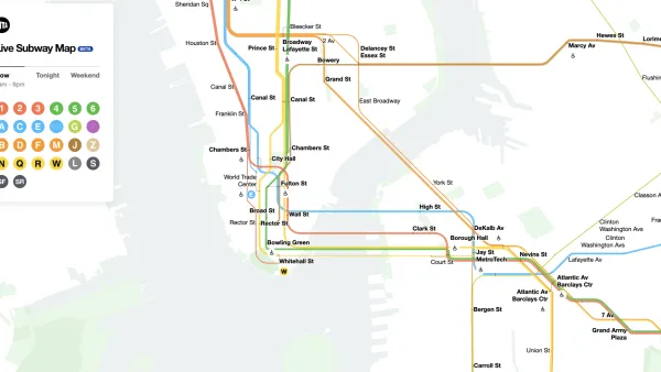
The New New York Subway Map Works in Real Time
There's a new chapter, and maybe an end, for the "Great Subway Map Debate."

Analysis: Cybertruck Fatality Rate Far Exceeds That of Ford Pinto
The Tesla Cybertruck was recalled seven times last year.

National Parks Layoffs Will Cause Communities to Lose Billions
Thousands of essential park workers were laid off this week, just before the busy spring break season.

Retro-silient?: America’s First “Eco-burb,” The Woodlands Turns 50
A master-planned community north of Houston offers lessons on green infrastructure and resilient design, but falls short of its founder’s lofty affordability and walkability goals.

Test News Post 1
This is a summary

Analysis: Cybertruck Fatality Rate Far Exceeds That of Ford Pinto
The Tesla Cybertruck was recalled seven times last year.

Test News Headline 46
Test for the image on the front page.
Urban Design for Planners 1: Software Tools
This six-course series explores essential urban design concepts using open source software and equips planners with the tools they need to participate fully in the urban design process.
Planning for Universal Design
Learn the tools for implementing Universal Design in planning regulations.
EMC Planning Group, Inc.
Planetizen
Planetizen
Mpact (formerly Rail~Volution)
Great Falls Development Authority, Inc.
HUDs Office of Policy Development and Research
NYU Wagner Graduate School of Public Service