


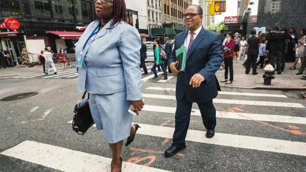
Although leaders in the Twin Cities seem to agree on the need to improve the appeal of city streets for those on foot, turning those words into actions seems difficult. Bill Lindeke offers three easy solutions that don't involve touching the street.
Though 'improving walkability' seems to be in every comprehensive plan developed in Minneapolis and St Paul, when it comes time for implementation it's a different story. Bill Lindeke explains, “when it comes down to any one particular project, the situation seems to change. A proposal goes out for traffic calming (say, on South Nicollet Avenue), and all of a sudden each parking space becomes crucial to the city’s economy, each lane of asphalt becomes vital to the regional transportation network, and (I’m sorry but) there’s no money to do anything at this time.” So, when it comes to improving sidewalks for enhanced pedestrian safety, “talk is cheap, and change is hard, and that goes double for concrete," he writes.
In light of the reluctance by cities to explore changes to the actual roadway, such as “road diets, sidewalk extensions, [and] lane narrowing”, Lindeke proposes three alternatives for improving pedestrian safety that can be achieved at little expense: adding red light cameras, installing "no turn on red" signs, and banning the use of cell phones while driving.
For Lindeke, these are no-brainers -- simple and inexpensive solutions that make immediate progress in supporting traffic calming, promoting walking, and increasing safety. He concludes, “All of these tactics are the equivalent of 'calling the bluff.' Sure there are some political challenges, but if cities and governments really meant what they said, they’d do one or all of these things."
FULL STORY: Three Ways to Improve Walkability Without Touching the Street

'Walking Summit' Highlights Long Path Ahead
A piece from the Congress for the New Urbanism discusses the 2017 National Walking Summit. The proceedings included the release of the nation's first walkability report card.
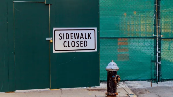
For Once, Cars, Not Pedestrians, Make Room for Construction
In a welcome turnabout of the usual state of affairs, a Philadelphia construction site gives a lane of traffic to pedestrians to make up for the three blocks of sidewalk it's taking.
The Walkable City of Death
San Francisco, one of the nation's most walkable cities, has one of the country's highest rates of pedestrian deaths.

National Parks Layoffs Will Cause Communities to Lose Billions
Thousands of essential park workers were laid off this week, just before the busy spring break season.

Retro-silient?: America’s First “Eco-burb,” The Woodlands Turns 50
A master-planned community north of Houston offers lessons on green infrastructure and resilient design, but falls short of its founder’s lofty affordability and walkability goals.

Delivering for America Plan Will Downgrade Mail Service in at Least 49.5 Percent of Zip Codes
Republican and Democrat lawmakers criticize the plan for its disproportionate negative impact on rural communities.

Test News Post 1
This is a summary

Test News Headline 46
Test for the image on the front page.

Balancing Bombs and Butterflies: How the National Guard Protects a Rare Species
The National Guard at Fort Indiantown Gap uses GIS technology and land management strategies to balance military training with conservation efforts, ensuring the survival of the rare eastern regal fritillary butterfly.
Urban Design for Planners 1: Software Tools
This six-course series explores essential urban design concepts using open source software and equips planners with the tools they need to participate fully in the urban design process.
Planning for Universal Design
Learn the tools for implementing Universal Design in planning regulations.
EMC Planning Group, Inc.
Planetizen
Planetizen
Mpact (formerly Rail~Volution)
Great Falls Development Authority, Inc.
HUDs Office of Policy Development and Research
NYU Wagner Graduate School of Public Service