


They're among the most populous cities in the world. So why are India's largest cities virtually bereft of skylines? Mark Bergen explores the answers.

Bergen reports from Bangalore, a city more populous than New York or Hong Kong, where one of the tallest buildings is only 420 feet.
"Cities in China and southeast Asia rise high, but Indian ones did not. Most grew like Bangalore: outwards and compact. Their skylines are almost nonexistent. And their urban ills -- millions without housing, millions more facing exorbitant rents and crumbling infrastructure -- are often given the economic prescription to grow up."
"It leads to a natural question: Why aren't Indian cities that tall? But there are others who pose a very different query: Why should they be?"
Limits on the availability of resources like electricity and water form a natural deterrent to vertical construction. "But the culprit for most Indian cities is the tight rein on building codes," explains Bergen. "The floor-area-ratio in Bangalore, up to 3.25 but around 1.25 in many areas, requires builders to pay for pricey land plots if they want to build up. (In a recent midtown rezoning, Manhattan proposed FARs as high as 24)."
Despite an institutional bias towards sprawl and low-rise housing, "some cities are now looking up. Recently, the national urban development minister urged New Delhi to permit more skyscrapers, and Gurgaon, a booming city in its periphery, floated an increased FAR. Bangalore, too, is seeing a slew of lofty, vertical projects."
FULL STORY: Why India Keeps Its Cities So Short

Will Upzoning Destroy the Beaux Arts Legacy of Midtown Manhattan?
A development proposal for a 1,450 glass skyscraper adjacent to Grand Central Station prompted the Architectural Record to wonder whether New York is chipping away the "Beaux Arts heart" of Manhattan.
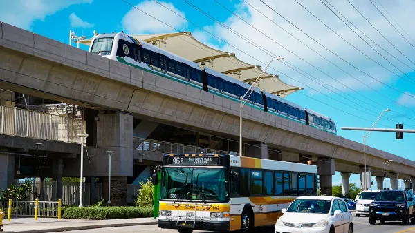
Honolulu Skyline Train Enters Final Construction Phase
The third phase of the project will expand service to downtown Honolulu on the ‘nation’s first large-scale, publicly run automated metro system.’

NYC Budget Makes Key Building Code Change
The change could spur more housing development if accompanying reforms in the City of Yes for Housing Opportunity plan are approved.

National Parks Layoffs Will Cause Communities to Lose Billions
Thousands of essential park workers were laid off this week, just before the busy spring break season.

Retro-silient?: America’s First “Eco-burb,” The Woodlands Turns 50
A master-planned community north of Houston offers lessons on green infrastructure and resilient design, but falls short of its founder’s lofty affordability and walkability goals.

Delivering for America Plan Will Downgrade Mail Service in at Least 49.5 Percent of Zip Codes
Republican and Democrat lawmakers criticize the plan for its disproportionate negative impact on rural communities.

Test News Post 1
This is a summary

Test News Headline 46
Test for the image on the front page.

Balancing Bombs and Butterflies: How the National Guard Protects a Rare Species
The National Guard at Fort Indiantown Gap uses GIS technology and land management strategies to balance military training with conservation efforts, ensuring the survival of the rare eastern regal fritillary butterfly.
Urban Design for Planners 1: Software Tools
This six-course series explores essential urban design concepts using open source software and equips planners with the tools they need to participate fully in the urban design process.
Planning for Universal Design
Learn the tools for implementing Universal Design in planning regulations.
EMC Planning Group, Inc.
Planetizen
Planetizen
Mpact (formerly Rail~Volution)
Great Falls Development Authority, Inc.
HUDs Office of Policy Development and Research
NYU Wagner Graduate School of Public Service