


Ever wonder what downtown Boston looked like on the eve of the Civil War? This photograph taken from a hot air balloon by James Wallace Black is thought to be the oldest aerial photo still in existence. Google Earth eat your heart out.
If you're looking for a dose of humor this week, look back at our collection of April Fool's Day stories. For something a bit more, ahem, sophisticated, we bring you the progenitor of the Google Earth and Bing Bird's Eye views of the world.
"The first flight of an untethered hot air balloon—humanity’s first really successful attempt at flight—took place in 1783 when “Pilâtre de Rozier and the Marquis d’Arlandes” flew over Paris. The first real photograph was taken in 1826 when Joseph Nicéphore Niépce took a picture out of his window," explains Colin Schultz.
"It took more than 30 years for someone to put these two inventions together to bring us the world’s first photo from the air. That photo, an 1858 aerial image of Paris, France, captured by Gaspard-Félix Tournachon is no longer with us. But the next best thing, says PetaPixel, is in the caring hands of the New York’s Metropolitan Museum of Art: an 1860 photograph of Boston captured from 2,000 feet."

Photo: James Wallace Black / The Met
FULL STORY: This Picture of Boston, Circa 1860, Is the World’s Oldest Surviving Aerial Photo

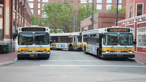
Boston Bus Signal Priority Project Yields Faster Travel Times
The city now plans to expand a year-long pilot project that reduced the time buses waited at traffic signals.
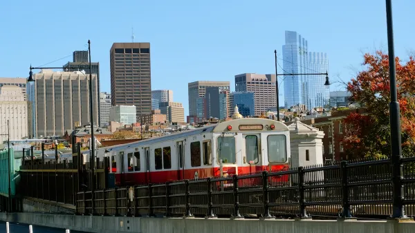
Boston Rail Network Sees Significant Increases in Speed After Eliminating ‘Slow Zones’
A year-long project that upgraded rail infrastructure and equipment has resulted in faster trips on all rail lines.

Boston Launches New Affordable Housing Preservation Fund
The Boston Acquisition Fund will offer low-interest loans to developers who pledge to keep multifamily housing affordable.

Analysis: Cybertruck Fatality Rate Far Exceeds That of Ford Pinto
The Tesla Cybertruck was recalled seven times last year.

National Parks Layoffs Will Cause Communities to Lose Billions
Thousands of essential park workers were laid off this week, just before the busy spring break season.

Retro-silient?: America’s First “Eco-burb,” The Woodlands Turns 50
A master-planned community north of Houston offers lessons on green infrastructure and resilient design, but falls short of its founder’s lofty affordability and walkability goals.

Test News Post 1
This is a summary

Analysis: Cybertruck Fatality Rate Far Exceeds That of Ford Pinto
The Tesla Cybertruck was recalled seven times last year.

Test News Headline 46
Test for the image on the front page.
Urban Design for Planners 1: Software Tools
This six-course series explores essential urban design concepts using open source software and equips planners with the tools they need to participate fully in the urban design process.
Planning for Universal Design
Learn the tools for implementing Universal Design in planning regulations.
EMC Planning Group, Inc.
Planetizen
Planetizen
Mpact (formerly Rail~Volution)
Great Falls Development Authority, Inc.
HUDs Office of Policy Development and Research
NYU Wagner Graduate School of Public Service