


With the latest redesign of Maps, Google is personalizing the mapping experience to reflect the places we, and our friends, frequent. In doing so, will the technology giant eliminate serendipitous "entanglements" from the urban experience?
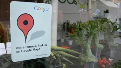
"In the near future (Google says it will 'be rolling it out to more people in the coming days and weeks'), the maps we see will be dynamically generated and highly personalized, giving preferential treatment to the places frequented by our social networking friends, the places we mention in our emails, the sites we look up on the search engine," writes Evgeny Morozov. "Conversely, the places that we haven't encountered—or, at least, haven't yet expressed any interest in encountering—will be harder to find."
"The problem with Google's vision is that it doesn't acknowledge the vital role that disorder, chaos, and novelty play in shaping the urban experience," he continues. "If Google has its way, our public space might soon look like the Californian suburbia that the company calls home: nice but isolated, sunny but relying on decrepit infrastructure, orderly but segregated by income."
Here's one idea for preserving surprise and serendipity in your urban explorations: turn off the smartphone.
FULL STORY: My Map or Yours?


Public Libraries May Be More Relevant Than Ever
Libraries around the country are expanding their services in an effort to become ‘third spaces’ for the community.

Neurodivergence and the City
Researchers are starting to understand how people with conditions like autism experience cities differently — and how to design for the neurodiverse brain.

Building Secure Yet Welcoming Public Spaces
Strategies for securing public spaces from vehicle attacks and other acts of terrorism without sacrificing accessible, vibrant urban places.

National Parks Layoffs Will Cause Communities to Lose Billions
Thousands of essential park workers were laid off this week, just before the busy spring break season.

Retro-silient?: America’s First “Eco-burb,” The Woodlands Turns 50
A master-planned community north of Houston offers lessons on green infrastructure and resilient design, but falls short of its founder’s lofty affordability and walkability goals.

Delivering for America Plan Will Downgrade Mail Service in at Least 49.5 Percent of Zip Codes
Republican and Democrat lawmakers criticize the plan for its disproportionate negative impact on rural communities.

Test News Post 1
This is a summary

Test News Headline 46
Test for the image on the front page.

Balancing Bombs and Butterflies: How the National Guard Protects a Rare Species
The National Guard at Fort Indiantown Gap uses GIS technology and land management strategies to balance military training with conservation efforts, ensuring the survival of the rare eastern regal fritillary butterfly.
Urban Design for Planners 1: Software Tools
This six-course series explores essential urban design concepts using open source software and equips planners with the tools they need to participate fully in the urban design process.
Planning for Universal Design
Learn the tools for implementing Universal Design in planning regulations.
EMC Planning Group, Inc.
Planetizen
Planetizen
Mpact (formerly Rail~Volution)
Great Falls Development Authority, Inc.
HUDs Office of Policy Development and Research
NYU Wagner Graduate School of Public Service