


A new study has quantified how Baron Georges-Eugene Haussmann's plans changed the form and function of Paris - a topic that had previously been open to the subjective analysis of urban theorists. The results might surprise you.
"[A] new study by a collaboration of mathematical physicists and social historians in France shows that, simply by analysing old and new maps of the city, it’s possible to quantify what effect Haussmann’s plans had on the shape and life of Paris," reports Philip Ball. "The results offer a case history of how cities may evolve through a combination of spontaneous self-organisation and top-down central planning."
"Marc Barthelemy of the CEA Institute of Theoretical Physics in the Parisian suburb of Gif-sur-Yvette and his colleagues have analysed maps of the city road network at six moments in time since the Revolution began: 1789, 1826, 1836, 1888, 1999 and 2010. They looked at some basic properties of the networks, such as the numbers of nodes (intersections) and edges (roads between intersections), as well as using more sophisticated concepts from the modern theory of complex networks, such as the quantity called 'betweenness centrality' (BC) that measures the importance of individual nodes to navigating the network."
"The results are revealing," says Ball. "Whether or not Haussmann made a difference depends on what you look at."
FULL STORY: The revolution that built the streets of Paris


France Tightens Restrictions on Short-Term Rentals
The vacation rental market is shouldering part of the blame for rising housing costs, particularly in popular tourist destinations.
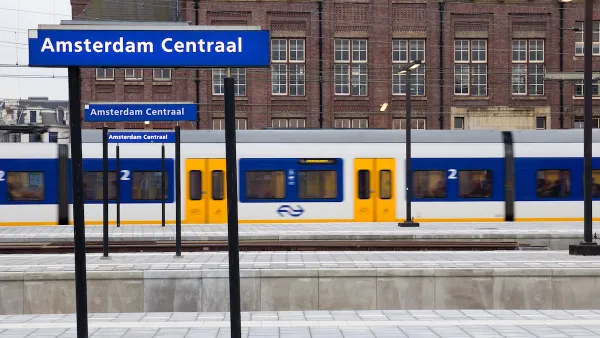
Eurostar Temporarily Closing Two High-Speed Rail Routes
Eurostar is temporarily closing routes from London to Disneyland Paris and London to Amsterdam.

Paris Approves First Aerial Gondola
An aerial tramway project in the French capital cleared feasibility studies and could open in 2025.

National Parks Layoffs Will Cause Communities to Lose Billions
Thousands of essential park workers were laid off this week, just before the busy spring break season.

Retro-silient?: America’s First “Eco-burb,” The Woodlands Turns 50
A master-planned community north of Houston offers lessons on green infrastructure and resilient design, but falls short of its founder’s lofty affordability and walkability goals.

Delivering for America Plan Will Downgrade Mail Service in at Least 49.5 Percent of Zip Codes
Republican and Democrat lawmakers criticize the plan for its disproportionate negative impact on rural communities.

Test News Post 1
This is a summary

Test News Headline 46
Test for the image on the front page.

Balancing Bombs and Butterflies: How the National Guard Protects a Rare Species
The National Guard at Fort Indiantown Gap uses GIS technology and land management strategies to balance military training with conservation efforts, ensuring the survival of the rare eastern regal fritillary butterfly.
Urban Design for Planners 1: Software Tools
This six-course series explores essential urban design concepts using open source software and equips planners with the tools they need to participate fully in the urban design process.
Planning for Universal Design
Learn the tools for implementing Universal Design in planning regulations.
EMC Planning Group, Inc.
Planetizen
Planetizen
Mpact (formerly Rail~Volution)
Great Falls Development Authority, Inc.
HUDs Office of Policy Development and Research
NYU Wagner Graduate School of Public Service