


The best models of the impacts of climate change have been devoted to understanding global, or even national, changes. But NASA has devoted significant computational resources to projecting future climate conditions at the neighborhood level.
"[N]ew NASA projections that take climate change to a more fine grained understanding," reports Ben Schiller. "Instead of the normal hifalutin picture, these images get down to the block-by-block. They show how Monowi, Nebraska, and Baneberry, Tennessee, are going to experience global warming, not whole continents or even countries or states."
"Climate projections normally deal in scales of 100 to 250 kilometers," explains Schiller. "NASA's new images are of the order of half a mile, or 800 meters. They're the product of past measurements, geographical readings, and a host of greenhouse gas data, all processed over 'hundreds of thousands of supercomputing hours.'"
“'The NEX-DCP30 dataset provides a higher resolution that will be of great reference to the decision-making of natural resource managers, urban planners and the climate change science community,' said Ramakrishna Nemani, senior Earth science researcher at Ames, and a co-author on the study. Details and availability of the new dataset were published in Eos, Transactions American Geophysical Union on Sept.10."
FULL STORY: Forget Continents Or Countries. This Is What Climate Change Will Do To Your Block


Land Use the Subject of Latest IPCC Report
Not urban land use, but in the literal sense: land used to produce food, graze livestock, supply drinking water, grow trees, and sequester carbon. As the climate warms and the population grows, crop yields will decrease and land will be degraded.
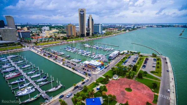
Visualizing Worst-Case Scenario Sea Level Rise on the Texas Coast
Much of the state political leadership in Texas has been slow to accept the existence of climate change, much less the role of the state's economy, land use, and infrastructure planning in exacerbating the crisis. Maybe this will help wake them up?

Rising Seas Could Submerge Much of Jersey Shore by 2100
The doomsday scenario for sea-level rise in New Jersey is worse than that of almost any other state.

National Parks Layoffs Will Cause Communities to Lose Billions
Thousands of essential park workers were laid off this week, just before the busy spring break season.

Retro-silient?: America’s First “Eco-burb,” The Woodlands Turns 50
A master-planned community north of Houston offers lessons on green infrastructure and resilient design, but falls short of its founder’s lofty affordability and walkability goals.

Delivering for America Plan Will Downgrade Mail Service in at Least 49.5 Percent of Zip Codes
Republican and Democrat lawmakers criticize the plan for its disproportionate negative impact on rural communities.

Test News Post 1
This is a summary

Test News Headline 46
Test for the image on the front page.

Balancing Bombs and Butterflies: How the National Guard Protects a Rare Species
The National Guard at Fort Indiantown Gap uses GIS technology and land management strategies to balance military training with conservation efforts, ensuring the survival of the rare eastern regal fritillary butterfly.
Urban Design for Planners 1: Software Tools
This six-course series explores essential urban design concepts using open source software and equips planners with the tools they need to participate fully in the urban design process.
Planning for Universal Design
Learn the tools for implementing Universal Design in planning regulations.
EMC Planning Group, Inc.
Planetizen
Planetizen
Mpact (formerly Rail~Volution)
Great Falls Development Authority, Inc.
HUDs Office of Policy Development and Research
NYU Wagner Graduate School of Public Service