


Debates rages on in response to the City Centre Access Strategy as it's revealed that the CBD could loose around 20% of its parking places and loading zones on two key streets to make way for the expanded cycle path scheme.
Further reading of the City Centre Access Strategy published by the O'Farrell government last month has revealed that hundreds of parking places and loading zones are to be replaced by cycle lanes. Fairfax Media, owners of the Sydney Morning Herald, suggest that this could mean the loss of 250 spaces, and suggest the dedicated cycle lanes would come at a great inconvenience to city business and their workers.
Chan Vongsarath, an electrical contractor working nearby commented that ''it's not feasible to pay $50 an hour for off-street parking and carry our tools down from the top floor''.
The City of Sydney Council have said that early estimates suggest that the CBD would loose 20% of its parking places and loading zones on Castlereagh and Kent streets. Wentworth Avenue, Pitt Street, King Street, Liverpool Street, Hay Street and Campbell Street would also loose some parking bays.
This decision is backed by the government's resolve to encourage off-street parking and estimates that there are 7,000 to 21,000 vacant spaces in the CBD per day. It is a position that David Borella, president of Bike Sydney, agrees with. ''We all still want our coffees and shopping items but the current transport landscape by far too much prioritises the parking of cars.''
FULL STORY: Parking spots make way for bike lanes

Expanding Bike Lanes a Focus of Sydney "Access Strategy"
New South Wales Government have published the "City Centre Access Strategy", their vision for transport planning in Sydney for the next two decades. Jacob Saulwick reviews the mixed responses to the long awaited plan.
Watch: How to Remove Thousands of Parking Spaces
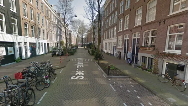
What the city of Amsterdam will gain by removing cars from on-street parking space.

A Shuttle Ride to the Trailhead
A pilot program by King County Metro and the King County Parks Department in the state of Washington found success in 2017, and is spending the beginning of 2018 looking at options to expand.

National Parks Layoffs Will Cause Communities to Lose Billions
Thousands of essential park workers were laid off this week, just before the busy spring break season.

Retro-silient?: America’s First “Eco-burb,” The Woodlands Turns 50
A master-planned community north of Houston offers lessons on green infrastructure and resilient design, but falls short of its founder’s lofty affordability and walkability goals.

Delivering for America Plan Will Downgrade Mail Service in at Least 49.5 Percent of Zip Codes
Republican and Democrat lawmakers criticize the plan for its disproportionate negative impact on rural communities.

Test News Post 1
This is a summary

Test News Headline 46
Test for the image on the front page.

Balancing Bombs and Butterflies: How the National Guard Protects a Rare Species
The National Guard at Fort Indiantown Gap uses GIS technology and land management strategies to balance military training with conservation efforts, ensuring the survival of the rare eastern regal fritillary butterfly.
Urban Design for Planners 1: Software Tools
This six-course series explores essential urban design concepts using open source software and equips planners with the tools they need to participate fully in the urban design process.
Planning for Universal Design
Learn the tools for implementing Universal Design in planning regulations.
EMC Planning Group, Inc.
Planetizen
Planetizen
Mpact (formerly Rail~Volution)
Great Falls Development Authority, Inc.
HUDs Office of Policy Development and Research
NYU Wagner Graduate School of Public Service