


In the face of rising pedestrian and bicyclist fatalities, the District of Columbia's police department began deploying automated photo enforcement technologies while San Francisco took a multi-agency, collaborative planning approach.
With bicycle and pedestrian fatalities increasing by 6.5 and 6.4 percent, respectively, we look at different approaches cities are taking to make streets safer for those who bike and walk.
In the District of Columbia, as we posted in September, they see traffic enforcement technology as playing a key role in reducing car collisions with pedestrians, particularly at crosswalks. Enforcement went into effect on Nov. 24, writes Kate Hinds. Five innovative photo-enforcement technologies beyond red light cameras are described and available on video on "DC Street Safe". For example, check out the 30-second video on new stop sign cameras.
The AAA called this approach to traffic safety "the nuclear option," reports Martin DiCaro of WAMU radio.
Chloe Johnson of the San Francisco Examiner writes of the collaboration of the San Francisco Municipal Transportation Agency, Planning Department, Public Health Department and City Controller’s Office to launch "WalkFirst". The goal is to "reduc(e) fatal pedestrian injuries by 25 percent by 2016 and 50 percent by 2021. Over the next five years, $17 million is expected to be spent on the effort." The WalkFirst report (PDF) prepared by the aforementioned agencies was published in Oct., 2011.
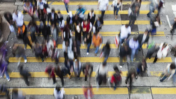
A third approach was taken in New York City, as we posted here on Friday, and illustrated below.

At Madison Avenue and 135th Street, a mix of additional pedestrian space and crossing time, turn restrictions, clearer markings, and tighter corners led to an 18 percent reduction in injuries. Photos: NYC DOT
FULL STORY: D.C. Traffic Cameras To Police Crosswalks, Stop Signs

Big Cities Make Pedestrian Safety a Priority
New data released Dec. 19 by NHTSA shows increased safety for those traveling by car, but pedestrian fatalities are 15% higher than in 2009. Plans by San Francisco, Los Angeles, New York, and Chicago to increase ped safety are described by the WSJ.
NYC Officials Split on Jaywalking Decriminalization
While some council members say the ‘outdated’ practice disproportionately impacts Black and Latino residents, law enforcement officials say its a necessary measure for road safety.
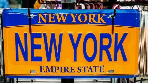
NYC Speed Cameras Tricked by Souvenir License Plates
A new way to skirt the city’s speeding laws: novelty license plates.

National Parks Layoffs Will Cause Communities to Lose Billions
Thousands of essential park workers were laid off this week, just before the busy spring break season.

Retro-silient?: America’s First “Eco-burb,” The Woodlands Turns 50
A master-planned community north of Houston offers lessons on green infrastructure and resilient design, but falls short of its founder’s lofty affordability and walkability goals.

Delivering for America Plan Will Downgrade Mail Service in at Least 49.5 Percent of Zip Codes
Republican and Democrat lawmakers criticize the plan for its disproportionate negative impact on rural communities.

Test News Post 1
This is a summary

Test News Headline 46
Test for the image on the front page.

Balancing Bombs and Butterflies: How the National Guard Protects a Rare Species
The National Guard at Fort Indiantown Gap uses GIS technology and land management strategies to balance military training with conservation efforts, ensuring the survival of the rare eastern regal fritillary butterfly.
Urban Design for Planners 1: Software Tools
This six-course series explores essential urban design concepts using open source software and equips planners with the tools they need to participate fully in the urban design process.
Planning for Universal Design
Learn the tools for implementing Universal Design in planning regulations.
EMC Planning Group, Inc.
Planetizen
Planetizen
Mpact (formerly Rail~Volution)
Great Falls Development Authority, Inc.
HUDs Office of Policy Development and Research
NYU Wagner Graduate School of Public Service