


Adding 1,100 people every month, Washington D.C. is in the midst of one of the nation’s most powerful examples of population growth. A recently developed heat map shows where supply is being built to meet the new demand.
Pulling data from the District of Columbia Data Catalogue, blog Map Attacks has created a map showing every active building permit in the city, as of January 10, 2014. The visualization is useful in projecting the future of the nation's capital, which is drawing a large influx of new residents.
Dan Reed provides some local insight about the patterns visible on the map: “there's a lot of construction occurring in downtown DC, though there's also a significant amount of building taking place near U Street. H Street and Columbia Heights are no slouch, as well as Fort Totten, where a new Walmart is under construction.” Reed describes the orientation of construction permits by referencing some of the political dynamics at play in the development climate of the capital: “[the bulk of new construction occurring east of Rock Creek Park is] a good thing after decades of disinvestment, but it also illustrates how resistance to new development west of the park has pushed demand further east.”
One caveat about the heat map and its dataset from Map Attacks: “This dataset captures large construction projects like the O Street Market development in Shaw, as well as someone renovating their bathroom in Georgetown.”
FULL STORY: See where building construction is happening in DC

Transit-Oriented Development Central to D.C. Region's Growth Plan
Transit-oriented development will play a key role in mitigating the congestion effects of growing population in the region around the nation's capital, and regional planners say the region is already achieving its goals.

A Relentless D.C. Zoning Activist
Chris Otten says change doesn't come from "being nice to decision makers," so he's comfortable being confrontational with developers and City Council members he sees as taking advantage of the poor.

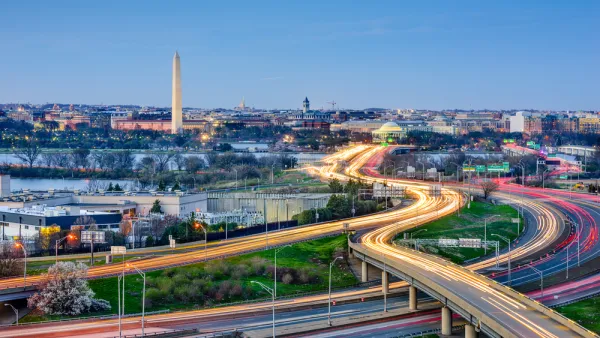
Explained: D.C. Gains '1,000 New Residents Every Month'
Officials and residents in Washington, D.C. are often heard saying that the District is gaining 1,000 new residents every month. But what does it mean?

National Parks Layoffs Will Cause Communities to Lose Billions
Thousands of essential park workers were laid off this week, just before the busy spring break season.

Retro-silient?: America’s First “Eco-burb,” The Woodlands Turns 50
A master-planned community north of Houston offers lessons on green infrastructure and resilient design, but falls short of its founder’s lofty affordability and walkability goals.

Delivering for America Plan Will Downgrade Mail Service in at Least 49.5 Percent of Zip Codes
Republican and Democrat lawmakers criticize the plan for its disproportionate negative impact on rural communities.

Test News Post 1
This is a summary

Test News Headline 46
Test for the image on the front page.

Balancing Bombs and Butterflies: How the National Guard Protects a Rare Species
The National Guard at Fort Indiantown Gap uses GIS technology and land management strategies to balance military training with conservation efforts, ensuring the survival of the rare eastern regal fritillary butterfly.
Urban Design for Planners 1: Software Tools
This six-course series explores essential urban design concepts using open source software and equips planners with the tools they need to participate fully in the urban design process.
Planning for Universal Design
Learn the tools for implementing Universal Design in planning regulations.
EMC Planning Group, Inc.
Planetizen
Planetizen
Mpact (formerly Rail~Volution)
Great Falls Development Authority, Inc.
HUDs Office of Policy Development and Research
NYU Wagner Graduate School of Public Service