


An intrepid Reddit user has produced a striking visualization for the economic importance of the country’s urban areas by splitting the nation’s GDP into two—the top 50 percent and the lower 50 percent.
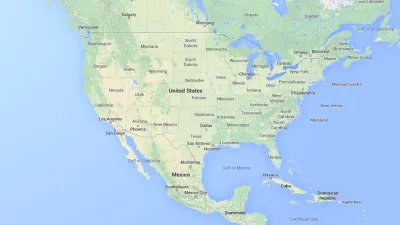
Reddit user Alexandr Trubetskoy has created a map that visualizes the country in two colors, with blue representing the bottom half of the country’s gross domestic product and orange representing the top half. On the map, a shocking amount of the country is covered in blue, and what’s left are the country's largest cities and metropolitan areas.
Writing for the Washington Post’s “the Fix,” Chris Cillizza shares one possible take away from the map: “ Those numbers make clear that while you may like to hate on big cities, you -- and we -- need them.”
FULL STORY: The case for big cities, in 1 map

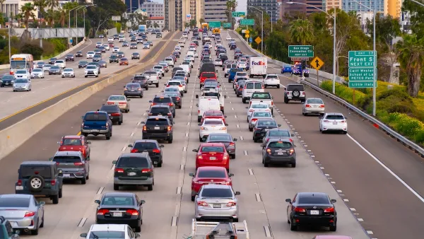
Opinion: Why Linking Driving to GDP Misses the Point
The argument that car-centric development is good because it boosts national GDP ignores the massive costs of driving to everyday Americans.
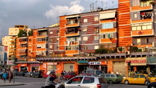
American Cities Should Be More Colorful
Designer Rachael Smith argues that a Puritan attitude toward color explains why so many American cities are clad in grays and browns, and links the gray-ification of cities to their gentrification.

Two Stories From 2020: Which Is True?
Have all cities lost people due to COVID-19, or just a few high-cost ones?

Analysis: Cybertruck Fatality Rate Far Exceeds That of Ford Pinto
The Tesla Cybertruck was recalled seven times last year.

National Parks Layoffs Will Cause Communities to Lose Billions
Thousands of essential park workers were laid off this week, just before the busy spring break season.

Retro-silient?: America’s First “Eco-burb,” The Woodlands Turns 50
A master-planned community north of Houston offers lessons on green infrastructure and resilient design, but falls short of its founder’s lofty affordability and walkability goals.

Test News Post 1
This is a summary

Analysis: Cybertruck Fatality Rate Far Exceeds That of Ford Pinto
The Tesla Cybertruck was recalled seven times last year.

Test News Headline 46
Test for the image on the front page.
Urban Design for Planners 1: Software Tools
This six-course series explores essential urban design concepts using open source software and equips planners with the tools they need to participate fully in the urban design process.
Planning for Universal Design
Learn the tools for implementing Universal Design in planning regulations.
EMC Planning Group, Inc.
Planetizen
Planetizen
Mpact (formerly Rail~Volution)
Great Falls Development Authority, Inc.
HUDs Office of Policy Development and Research
NYU Wagner Graduate School of Public Service