


“Lean urbanism” is the latest buzz-worthy term to enter the discussion on planning and urbanism. A recent article in Atlantic Cities explains the concept—which appeals to the younger generation as well as those with libertarian leanings.

Anthony Flint recently interviewed Andrés Duany on the subject of “lean urbanism,” which recently received a high level of institutional backing in the form of a $600,000 grant from the Knight Foundation for work in Detroit. For those interested in learning more about lean urbanism, Flint’s interview provides access to this latest concept in the lexicon of planning.
According to Duany, red tape is the problem: “Common sense has been almost completely lost in my profession. There are too many protocols in the way.”
“The lean urbanism concept, he says, is like a software patch, or a workaround – ultimately a guide or a tip sheet to navigate the complicated, and often very expensive, maze of working in the built environment in the U.S.,” writes Flint. Duany describes lean urbanism as “not a philosophical approach, but a narrow seam of activity, a sharing of secret knowledge.”
For how lean urbanism relates to the constellation of concepts by which planners and urbanists organize their ideas, Flint compares the work of lean urbanism to more familiar projects. “Tactical urbanism – the unsanctioned demonstration projects of creating a parklet or ‘chair bombing’ a street – might be thought of as at one end of this spectrum. Groups like CNU, the American Planning Association, the Urban Land Institute and SmartGrowth America are operating at a higher political level, pushing policy reform. Lean urbanism, as Duany defines it, seeks to occupy the space between, helping guide urban development in a more practical manner.”
FULL STORY: Why Andrés Duany Is So Focused on Making 'Lean Urbanism' a Thing


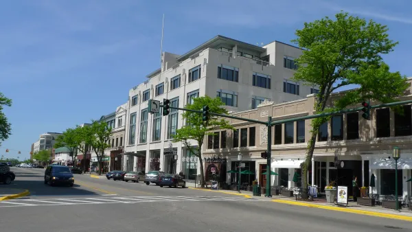
Detroit—Model of Lean Urbanism
The Knight Foundation has announced funding for the Project for Lean Urbanism, led by Andrés Duany. In a recent article, Duany applies concepts from Lean Urbanism in examining the case of Detroit as the next in a line of revitalized urban settings.
Duany Details the "New, New Urbanism"
At the CNU-FL statewide meeting held last week, Andrés Duany articulated his vision for how planning must adapt to the new realities of "national impoverishment" and climate change by utilizing the tools of tactical urbanism, writes Erin Chantry.
'The Users' Guide to Zoning Reform' Published by the Congress for New Urbanism
The Congress for New Urbanism's Users' "Guide to Code Reform" leads planners through the code reform process, providing tools for governments lacking the capacity to develop a full form-based code.

National Parks Layoffs Will Cause Communities to Lose Billions
Thousands of essential park workers were laid off this week, just before the busy spring break season.

Retro-silient?: America’s First “Eco-burb,” The Woodlands Turns 50
A master-planned community north of Houston offers lessons on green infrastructure and resilient design, but falls short of its founder’s lofty affordability and walkability goals.

Delivering for America Plan Will Downgrade Mail Service in at Least 49.5 Percent of Zip Codes
Republican and Democrat lawmakers criticize the plan for its disproportionate negative impact on rural communities.

Test News Post 1
This is a summary

Test News Headline 46
Test for the image on the front page.

Balancing Bombs and Butterflies: How the National Guard Protects a Rare Species
The National Guard at Fort Indiantown Gap uses GIS technology and land management strategies to balance military training with conservation efforts, ensuring the survival of the rare eastern regal fritillary butterfly.
Urban Design for Planners 1: Software Tools
This six-course series explores essential urban design concepts using open source software and equips planners with the tools they need to participate fully in the urban design process.
Planning for Universal Design
Learn the tools for implementing Universal Design in planning regulations.
EMC Planning Group, Inc.
Planetizen
Planetizen
Mpact (formerly Rail~Volution)
Great Falls Development Authority, Inc.
HUDs Office of Policy Development and Research
NYU Wagner Graduate School of Public Service