


A new web-based program, Global Forest Watch, provides access to almost real-time visualization of forests around the world.
Jared Green reports on a web-based tool, Global Forest Watch that “aims to provide a “near-real time” view of deforestation (and reforestation) around the world.” The program, which is provided by World Resources Institute, allows unprecedented visualization of deforestation: “As Rebecca Moore, engineering manager with Google Earth, explained to Reuters: 'With the exception of Brazil, none of the tropical forest countries have been able to report the state of their forests. Now it will be possible to have near real-time updates of the state of the world’s forests, open to anyone to use.'”
The web tool “uses more than half a billion high-res images from NASA’s Landsat program, which are organized with new algorithms created by the University of Maryland, and then made available for easy online access thanks to the cloud computing power of Google’s Earth and Maps engines.” Users and watch groups can collect information as well as “submit data, pictures, and video on the ground.”
The benefits of this crowdsourcing ability is a “near real-time” monitoring of existing tree cover anywhere in the world. “BBC News writes that high-res images of global tree loss and gain are updated annually while data on tropical forests is updated monthly.”
FULL STORY: Tracking Global Deforestation (and Reforestation)

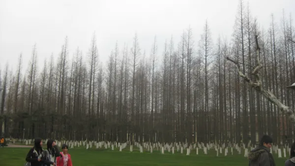
China Plants 'Great Green Wall' of Trees
Net deforestation continues, but at a slower rate as the world's largest ecological engineering project stretches for a planned 2,800 miles. It is hoped the new trees will halt the advance of the Gobi Desert.
How to Prevent National Forests Becoming 'National Ashtrays'
An editorial calls for innovative policy in post-fire recovery and reforestation. The recent release of the Environmental Impact Statement for the recovery of the Rim Fire should serve as a barometer for a "new public forestry."

From Academia to Action: An Indigenous Reforestation Effort in Los Angeles
Ary Amaya, a UCLA graduate student, leads an Indigenous-led reforestation effort in Los Angeles, integrating cultural practices and ecological restoration across 27 acres to promote Indigenous sovereignty and sustainable land management.

National Parks Layoffs Will Cause Communities to Lose Billions
Thousands of essential park workers were laid off this week, just before the busy spring break season.

Retro-silient?: America’s First “Eco-burb,” The Woodlands Turns 50
A master-planned community north of Houston offers lessons on green infrastructure and resilient design, but falls short of its founder’s lofty affordability and walkability goals.

Delivering for America Plan Will Downgrade Mail Service in at Least 49.5 Percent of Zip Codes
Republican and Democrat lawmakers criticize the plan for its disproportionate negative impact on rural communities.

Test News Post 1
This is a summary

Test News Headline 46
Test for the image on the front page.

Balancing Bombs and Butterflies: How the National Guard Protects a Rare Species
The National Guard at Fort Indiantown Gap uses GIS technology and land management strategies to balance military training with conservation efforts, ensuring the survival of the rare eastern regal fritillary butterfly.
Urban Design for Planners 1: Software Tools
This six-course series explores essential urban design concepts using open source software and equips planners with the tools they need to participate fully in the urban design process.
Planning for Universal Design
Learn the tools for implementing Universal Design in planning regulations.
EMC Planning Group, Inc.
Planetizen
Planetizen
Mpact (formerly Rail~Volution)
Great Falls Development Authority, Inc.
HUDs Office of Policy Development and Research
NYU Wagner Graduate School of Public Service