


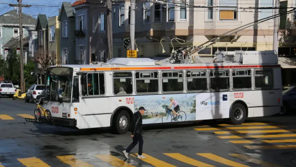
Proposals for light rail, streetcar, and BRT lines spread in every direction from Washington D.C. into nearby climes. Although some are more realistic than others, one blog dares to dream about what the full extent of the proposals would look like.
Dan Malouff writes a post, and creates a map, that imagines the full extent of the 267 miles of proposed light rail, streetcar, and bus rapid transit lines proposed in the D.C. metro area.
"This map combines the DC streetcar and MoveDC bus lane plan with the Arlington streetcar plan, the Alexandria transitway plan, Montgomery's BRT plan, and Fairfax's transit network plan, plus the Purple Line, the Corridor Cities Transitway, the Long Bridge study, the Wilson Bridge transit corridor, and finally the Southern Maryland transit corridor."
Malouff provides the caveat that it would be decades before all this infrastructure could be built, if ever. Some of the plans have been in the works since the 1990s, and others are so new that have yet to receive a feasibility study.
"But still," says Malouff, "267 miles is an awfully impressive network. Now let's build it."
FULL STORY: The DC region has over 250 miles of planned light rail, streetcar, & BRT

The Transit Catastrophe Continues: San Francisco, D.C. Forecast Service Cuts, Layoffs
Advocates have been waiting for the other shoe to drop as transit agencies deal with cratered revenues during the pandemic without support from Congress.
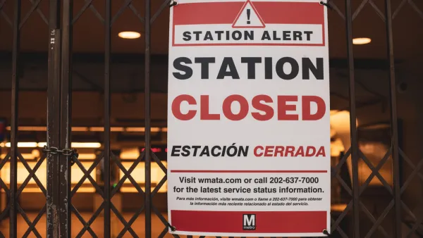
D.C. Metro Seeks Public Input on Proposed Service Cuts
D.C. Metro Seeks Public Input on Proposed Service Cuts
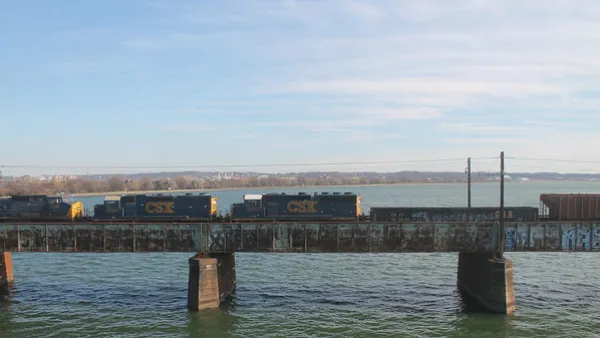
Key Virginia Rail Bridge Project Completes Environmental Review
A $1.9 billion project to add a second set of rail tracks to the Long Bridge that connects Virginia to D.C. is ready to move forward with a recently completed Environmental Impact Statement.

Analysis: Cybertruck Fatality Rate Far Exceeds That of Ford Pinto
The Tesla Cybertruck was recalled seven times last year.

National Parks Layoffs Will Cause Communities to Lose Billions
Thousands of essential park workers were laid off this week, just before the busy spring break season.

Retro-silient?: America’s First “Eco-burb,” The Woodlands Turns 50
A master-planned community north of Houston offers lessons on green infrastructure and resilient design, but falls short of its founder’s lofty affordability and walkability goals.

Test News Post 1
This is a summary

Analysis: Cybertruck Fatality Rate Far Exceeds That of Ford Pinto
The Tesla Cybertruck was recalled seven times last year.

Test News Headline 46
Test for the image on the front page.
Urban Design for Planners 1: Software Tools
This six-course series explores essential urban design concepts using open source software and equips planners with the tools they need to participate fully in the urban design process.
Planning for Universal Design
Learn the tools for implementing Universal Design in planning regulations.
EMC Planning Group, Inc.
Planetizen
Planetizen
Mpact (formerly Rail~Volution)
Great Falls Development Authority, Inc.
HUDs Office of Policy Development and Research
NYU Wagner Graduate School of Public Service