


Amanda Eaken details Kern County's new Regional Transportation Plan/Sustainable Communities Strategy (RTP/SCS). The new plan implements California's SB 375, which serves as the land use component of California's carbon emissions reductions goals.
"With the third most polluted air in the country in 2013, the 5th fastest growth rate of all California counties in 2012, and now a steady state-wide stream of funding to support sustainable communities from cap and trade proceeds, Kern County has much to gain from sustainable planning."
Eaken's coverage of the new plan breaks the plans into list of "good news" and "bad news" about what the plan achieves and where it falls short.
Among the positives, according to Eaken:
- The plan "contains seven times more funding both for transit (exclusive of high speed rail) and for bicycle/pedestrian infrastructure compared with their last long range transportation plan adopted in 2011."
- The plan anticipates future changes in housing demand: "the adopted plan’s land use scenario accommodates 21% of new development in infill areas as opposed to only 1% in the 2011 plan, and it places more emphasis on multi-family and small-lot single family homes in an effort to create more walkable communities."
And then some of the plan's shortcomings, according to Eaken:
- The plan did not adopt the Balanced Growth Scenario supported by the National Resources Defense Council and will pursue the Centennial Corridor highway plan, "slated to demolish over 200 homes in an historic neighborhood."
- The plan still targets greenfield development: "the RTP/SCS is projected to consume over 91 square miles of farmland, working landscapes and other open space, an area more than half the size of Bakersfield."
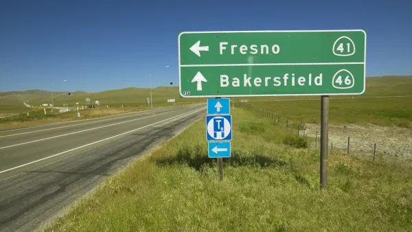
FULL STORY: 'Cause how many of you that sit and judge me, ever walked the streets of Bakersfield?


California's Great Transportation Divide—Between Two Key Governmental Agencies
Two powerful governmental bodies that deal with very different aspects of transportation—one with meeting mobility needs, the other with its impact on health and the environment—met formally for the first time on June 27.
Urban Planning for Public Health in California’s San Joaquin Valley
The American Lung Association is making an “urban planning push” in three San Joaquin Valley counties, according to a recent article in Associations Now. The idea behind the efforts to reduce public health risks: promote walkable communities.
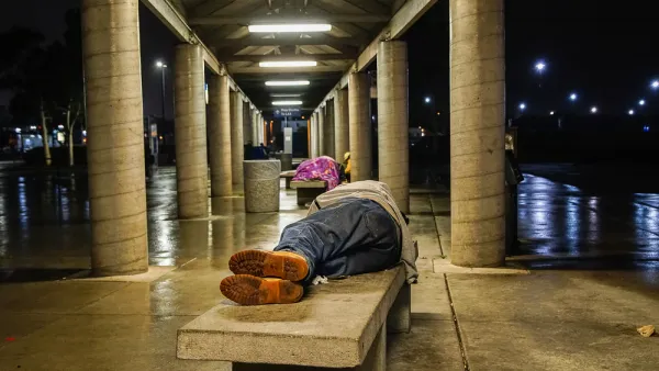
Homeless Counts Fall Short in Gathering Accurate Statistics
Assessing the scale of homelessness in the United States is surprisingly difficult, with statistics failing to capture the diversity of unhoused people and their situations.

National Parks Layoffs Will Cause Communities to Lose Billions
Thousands of essential park workers were laid off this week, just before the busy spring break season.

Retro-silient?: America’s First “Eco-burb,” The Woodlands Turns 50
A master-planned community north of Houston offers lessons on green infrastructure and resilient design, but falls short of its founder’s lofty affordability and walkability goals.

Delivering for America Plan Will Downgrade Mail Service in at Least 49.5 Percent of Zip Codes
Republican and Democrat lawmakers criticize the plan for its disproportionate negative impact on rural communities.

Test News Post 1
This is a summary

Test News Headline 46
Test for the image on the front page.

Balancing Bombs and Butterflies: How the National Guard Protects a Rare Species
The National Guard at Fort Indiantown Gap uses GIS technology and land management strategies to balance military training with conservation efforts, ensuring the survival of the rare eastern regal fritillary butterfly.
Urban Design for Planners 1: Software Tools
This six-course series explores essential urban design concepts using open source software and equips planners with the tools they need to participate fully in the urban design process.
Planning for Universal Design
Learn the tools for implementing Universal Design in planning regulations.
EMC Planning Group, Inc.
Planetizen
Planetizen
Mpact (formerly Rail~Volution)
Great Falls Development Authority, Inc.
HUDs Office of Policy Development and Research
NYU Wagner Graduate School of Public Service