


A heavily wooded park requires investments in maps and trails to be truly pedestrian-friendly.

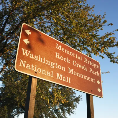
Last weekend, I visited Rock Creek Park in Washington, D.C. Rock Creek Park is quite different from the parks I am used to in New York City, both in good ways and in bad ways.
On the positive side, Rock Creek Park is more wooded and natural-looking than most parks. While a typical park is mostly grassland, Rock Creek Park is mostly forest. I saw three deer in the park over the course of an hour or two, which is three more than I would normally see in a park.
On the other hand, Rock Creek Park seems to me to be made for cars rather than for pedestrians. Although there are certainly some pedestrian entrances to the park, one of the main entrances, Military Road, is a high-speed road with no sidewalks in the blocks closest to the park.
As I walked along the park’s eastern border on 16th Street N.W., I only saw one or two pedestrian trails per mile leading westward through the park. Because the park is so densely forested, the only feasible way to walk through the park is through those trails. And as I walked, I didn’t really have a good idea where I was going; in the course of my two-mile walk from 16th Street to Military Road, I saw only one map—and even that one was more focused on the park’s interior than on how to get out of the park.
Unfortunately, Rock Creek Park has the virtues of its defects. A typical grassland park is pretty easy for a pedestrian to navigate; to get from the east end of New York's Central Park to the west end, all a pedestrian need do is walk across the grass and keep walking. A more heavily forested park such as Rock Creek Park can be quite impressive, but may need a bit more planning to be pedestrian-friendly. In particular, such a park may need more visible trails than other parks, and may need more maps to guide pedestrians.


New Orleans Planning a Pedestrian-Friendly Makeover of the French Quarter
Pedestrian improvements are planned as an economic development opportunity in one of the most pedestrian-friendly places in the entire country—the French Quarter of New Orleans.

Debunking Traffic Safety Myths as Pedestrian Fatalities Increase
Angie Schmitt, former editor at Streetsblog USA, has written a new book about pedestrian fatalities, which works to dispel some of the myths about traffic safety in the United States.

Keeping Bees Away from Honey? Corruption Cases Expose Flaws in L.A. City’s Land Entitlement Process
Three former Los Angeles public officials share their collective perspective on how best to reform the city of Los Angeles' corrupted land use approval process.

National Parks Layoffs Will Cause Communities to Lose Billions
Thousands of essential park workers were laid off this week, just before the busy spring break season.

Retro-silient?: America’s First “Eco-burb,” The Woodlands Turns 50
A master-planned community north of Houston offers lessons on green infrastructure and resilient design, but falls short of its founder’s lofty affordability and walkability goals.

Delivering for America Plan Will Downgrade Mail Service in at Least 49.5 Percent of Zip Codes
Republican and Democrat lawmakers criticize the plan for its disproportionate negative impact on rural communities.

Test News Post 1
This is a summary

Test News Headline 46
Test for the image on the front page.

Balancing Bombs and Butterflies: How the National Guard Protects a Rare Species
The National Guard at Fort Indiantown Gap uses GIS technology and land management strategies to balance military training with conservation efforts, ensuring the survival of the rare eastern regal fritillary butterfly.
Urban Design for Planners 1: Software Tools
This six-course series explores essential urban design concepts using open source software and equips planners with the tools they need to participate fully in the urban design process.
Planning for Universal Design
Learn the tools for implementing Universal Design in planning regulations.
EMC Planning Group, Inc.
Planetizen
Planetizen
Mpact (formerly Rail~Volution)
Great Falls Development Authority, Inc.
HUDs Office of Policy Development and Research
NYU Wagner Graduate School of Public Service