


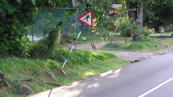
Focusing on street safety conditions in Miami as a case study of larger findings, a Governing magazine analysis finds that pedestrians are much more likely to be killed by cars in impoverished neighborhoods.
Describing Miami’s 79th Street as an "especially dangerous thruway," Mike Maciag says the street "exemplifies a troubling reality of urban areas across the country: Pedestrian deaths are much more common in low-income areas than in better-off parts of a city."
Maciag's article explains a Governing analysis "of accident location coordinates for the more than 22,000 pedestrians killed nationwide between 2008 and 2012." Their finding: "poorer neighborhoods have disproportionately higher rates of pedestrian deaths." Stated in more detail:
"the bottom third of Census tracts, in terms of per capita income, recorded pedestrian fatality rates twice that of higher income tracts."
"Metro-area Census tracts with poverty rates below the national rate of 15 percent registered 5.3 deaths per 100,000 residents over the five-year period, while in high-poverty areas where more than a quarter of the population lives in poverty, the rate was 12.1."
Governing's coverage of the analysis includes more a lot more detail and storytelling from Maciag, as well as full results and methodology of the analysis, and an interactive map of fatal pedestrian accidents.
FULL STORY: Pedestrians Dying at Disproportionate Rates in America's Poorer Neighborhoods

Complete Streets Policies Still Seeking Equity
Though the quick expansion of complete streets policies is worth celebrating, minority and low-income communities are still being left behind, and killed at a disproportionate rate.

The Vicious Cycle at the Heart of Pedestrian Safety
When people feel unsafe, they walk less; with fewer pedestrians, walking becomes less safe.

Cincinnati Gets Serious About Pedestrian Safety
A new in-house team dedicated to pedestrian safety at Cincinnati City Hall and a new complete streets ordinance are some of the changes underway in Cincinnati.

National Parks Layoffs Will Cause Communities to Lose Billions
Thousands of essential park workers were laid off this week, just before the busy spring break season.

Retro-silient?: America’s First “Eco-burb,” The Woodlands Turns 50
A master-planned community north of Houston offers lessons on green infrastructure and resilient design, but falls short of its founder’s lofty affordability and walkability goals.

Delivering for America Plan Will Downgrade Mail Service in at Least 49.5 Percent of Zip Codes
Republican and Democrat lawmakers criticize the plan for its disproportionate negative impact on rural communities.

Test News Post 1
This is a summary

Test News Headline 46
Test for the image on the front page.

Balancing Bombs and Butterflies: How the National Guard Protects a Rare Species
The National Guard at Fort Indiantown Gap uses GIS technology and land management strategies to balance military training with conservation efforts, ensuring the survival of the rare eastern regal fritillary butterfly.
Urban Design for Planners 1: Software Tools
This six-course series explores essential urban design concepts using open source software and equips planners with the tools they need to participate fully in the urban design process.
Planning for Universal Design
Learn the tools for implementing Universal Design in planning regulations.
EMC Planning Group, Inc.
Planetizen
Planetizen
Mpact (formerly Rail~Volution)
Great Falls Development Authority, Inc.
HUDs Office of Policy Development and Research
NYU Wagner Graduate School of Public Service