


Ben Schulman and Xiaoran Li lead an interesting thought experiment about the populations of cities around the country. That is, what would happen to the population of American cities if all their sizes were standardized?
"While the health of cities is often discussed in terms of population, what’s often lost in the discussion, at least outside of certain wonky urbanist circles, is the size of cities in geographic terms," explains Schulman and Li. "Putting density and urban design aside, simply taking a quick look at the square mileage of American cities reveals a wide disparity, from the 757.7 square miles of Jacksonville, FL to the 14.79 square miles of Jersey City, NJ."
Why does the size comparison matter? According to the authors of the article, "Although cities are often judged prima facie, not to mention showered with congressional dollars via census results, based on population figures, perhaps a straight reading of the numbers isn’t a good barometer of the merits or demerits of a place given the wild variances in the geographic size of cities."
Schulman and Li proceed to describe the methodology of their experiment, which established an average size, in square miles, for American cities—355 square miles, in fact. Then, setting a 355 square box around a central coordinate in the downtown core of each metro area, either expanded or contracted the boundaries of the city.
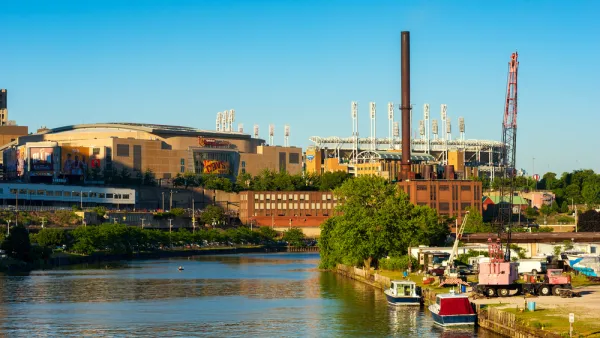
The story of what is gained and lost is interesting in Chicago and New York City, but especially interesting in Rust Belt cities like Detroit, Cleveland, Pittsburgh, and Buffalo. According to the authors, "[for] Rust Belt cities who have experienced massive population loss and whose recent histories read as exemplars of post-industrial urban failure, the numbers seem to reveal a story of dispersal, rather than absolute decline."
FULL STORY: Population Ain't Nothing But a Number: Standardizing the Size of the Great American City

How Legacy Cities Can Support Equitable Development
A new report outlines seven strategies for balancing economic development and equity specifically aimed at smaller, post-industrial cities.

Economic Recovery in Legacy Cities
Americans living in legacy cities face a unique set of challenges and opportunities in recovering from the COVID-19 pandemic. Several local, state, and federal support strategies could aid these cities in recouping losses.

Are Cities Really Losing Millennials?
Despite headlines to the contrary, the nation's most urbanized places appear to have gained thirtysomethings in recent years.

National Parks Layoffs Will Cause Communities to Lose Billions
Thousands of essential park workers were laid off this week, just before the busy spring break season.

Retro-silient?: America’s First “Eco-burb,” The Woodlands Turns 50
A master-planned community north of Houston offers lessons on green infrastructure and resilient design, but falls short of its founder’s lofty affordability and walkability goals.

Delivering for America Plan Will Downgrade Mail Service in at Least 49.5 Percent of Zip Codes
Republican and Democrat lawmakers criticize the plan for its disproportionate negative impact on rural communities.

Test News Post 1
This is a summary

Test News Headline 46
Test for the image on the front page.

Balancing Bombs and Butterflies: How the National Guard Protects a Rare Species
The National Guard at Fort Indiantown Gap uses GIS technology and land management strategies to balance military training with conservation efforts, ensuring the survival of the rare eastern regal fritillary butterfly.
Urban Design for Planners 1: Software Tools
This six-course series explores essential urban design concepts using open source software and equips planners with the tools they need to participate fully in the urban design process.
Planning for Universal Design
Learn the tools for implementing Universal Design in planning regulations.
EMC Planning Group, Inc.
Planetizen
Planetizen
Mpact (formerly Rail~Volution)
Great Falls Development Authority, Inc.
HUDs Office of Policy Development and Research
NYU Wagner Graduate School of Public Service