


An ongoing planning effort in Oklahoma City would revitalize a neighborhood adjacent to the city's downtown core long neglected by bad planning.
Dustin Akers tipped off Angie Schmitt at Streetsblog about the goings on in Oklahoma City's "Core to Shore" area. A comparison of aerial photos, one from 1932 and one from 2014, make the point about the city's radical transformation over the past 80 years. So what happened? "The answer, according to Akers, boils down to a few things: An elevated highway, misguided urban renewal policies, flight and disinvestment," writes Schmitt.
Enter the city's Core to Shore plan, which, according to the city's website, calls for the following:
- Creation of a world-class, pedestrian-friendly boulevard
- Development of a 40-acre central park
- Development of business, retail and mixed use housing along the central park
- Building of a Convention Center and Convention Center hotel
- Relocation of some of the existing businesses and homes in the area
The plan dates back to 2006 (and adopted in 2008 [pdf]), but the city's website includes updates, including a market study from 2007 [pdf] and a study by the Urban Land Institute [pdf] from 2010.
FULL STORY: Before/After: The 80-Year Leveling of an Oklahoma City Neighborhood


BikeWalkOKC Plan Updated After Five Years of Progress
The BikeWalkOKC plan has proceeded faster than expected after its approval in 2018. A 2023 update is expected to pick up where the 2018 plan left off.
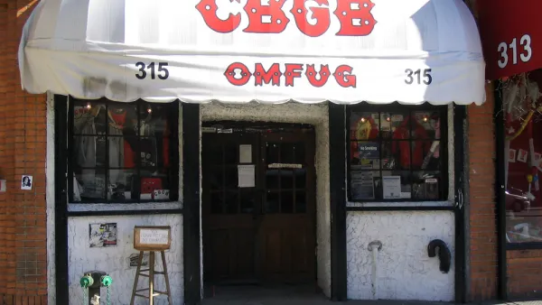
Opinion: Lower Rents Will Give Downtown Spaces Back to the ‘Weirdos’
Introducing the “CBGB theory of city planning.”

East Lansing Parking Plan Aims for Walkability
East Lansing wants to ditch some of its surface parking to encourage economic activity and walkability.

National Parks Layoffs Will Cause Communities to Lose Billions
Thousands of essential park workers were laid off this week, just before the busy spring break season.

Retro-silient?: America’s First “Eco-burb,” The Woodlands Turns 50
A master-planned community north of Houston offers lessons on green infrastructure and resilient design, but falls short of its founder’s lofty affordability and walkability goals.

Delivering for America Plan Will Downgrade Mail Service in at Least 49.5 Percent of Zip Codes
Republican and Democrat lawmakers criticize the plan for its disproportionate negative impact on rural communities.

Test News Post 1
This is a summary

Test News Headline 46
Test for the image on the front page.

Balancing Bombs and Butterflies: How the National Guard Protects a Rare Species
The National Guard at Fort Indiantown Gap uses GIS technology and land management strategies to balance military training with conservation efforts, ensuring the survival of the rare eastern regal fritillary butterfly.
Urban Design for Planners 1: Software Tools
This six-course series explores essential urban design concepts using open source software and equips planners with the tools they need to participate fully in the urban design process.
Planning for Universal Design
Learn the tools for implementing Universal Design in planning regulations.
EMC Planning Group, Inc.
Planetizen
Planetizen
Mpact (formerly Rail~Volution)
Great Falls Development Authority, Inc.
HUDs Office of Policy Development and Research
NYU Wagner Graduate School of Public Service