


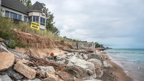
Climate change and rising seas will mean higher flood risks for cities. But when exactly will impactful flooding become a regular occurrence? New analysis by the Union of Concerned Scientists says that time is fast approaching.
Planners working on resilience against flooding take heed. A report, released this month by the Union of Concerned Scientists, says tidal flooding may soon affect urban areas, especially on the Atlantic and Gulf coasts. Forecasts of hurricane and storm risks are plentiful in the wake of Sandy and Katrina, but research into higher tides is harder to come by.
Melanie Fitzpatrick, one of the researchers who compiled the report, remarked, “The shock for us was that tidal flooding could become the new normal in the next 15 years; we didn’t think it would be so soon.”
The team used sea-level data from the recent National Climate Assessment and from Climate Central to determine that “in the absence of flood-deflecting marshes, seawalls or levees, two-thirds of the 52 communities studied can expect a tripling in the frequency of high-tide flooding during the next 15 years.”
The researchers conclude that tidal “nuisance flooding,” though not as dramatic as a major storm, is a real and apparent resilience challenge. They advocate communication between affected cities to coordinate best responses. The article includes an interactive map that displays the report’s flooding predictions for U.S. cities based on a number of parameters.
FULL STORY: Sea Level Rise Making Floods Routine for Coastal Cities

How US Cities Can Prepare for Climate Disasters
Resilience, encompassing infrastructure, governance, economic strength, and social cohesion, is critical for cities to mitigate rising climate risks like flooding, wildfires, and heat, ensuring long-term recovery and adaptability.
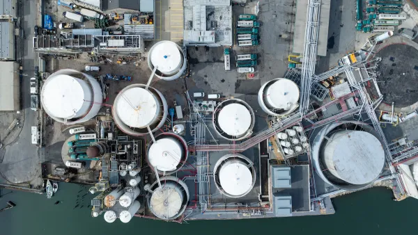
Climate Change Putting Coastal Infrastructure at Risk
More than 1,000 coastal facilities could flood as often as once a month as sea levels rise, according to a study from the Union of Concerned Scientists.
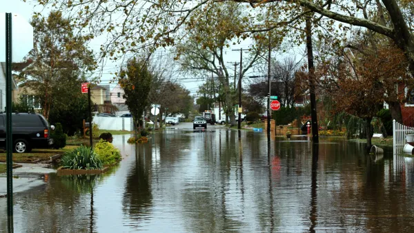
New York Updating its Flood Resilience Zoning
New York City intends to make sure that zoning codes are a tool for preventing the risks of flooding.

National Parks Layoffs Will Cause Communities to Lose Billions
Thousands of essential park workers were laid off this week, just before the busy spring break season.

Retro-silient?: America’s First “Eco-burb,” The Woodlands Turns 50
A master-planned community north of Houston offers lessons on green infrastructure and resilient design, but falls short of its founder’s lofty affordability and walkability goals.

Delivering for America Plan Will Downgrade Mail Service in at Least 49.5 Percent of Zip Codes
Republican and Democrat lawmakers criticize the plan for its disproportionate negative impact on rural communities.

Test News Post 1
This is a summary

Test News Headline 46
Test for the image on the front page.

Balancing Bombs and Butterflies: How the National Guard Protects a Rare Species
The National Guard at Fort Indiantown Gap uses GIS technology and land management strategies to balance military training with conservation efforts, ensuring the survival of the rare eastern regal fritillary butterfly.
Urban Design for Planners 1: Software Tools
This six-course series explores essential urban design concepts using open source software and equips planners with the tools they need to participate fully in the urban design process.
Planning for Universal Design
Learn the tools for implementing Universal Design in planning regulations.
EMC Planning Group, Inc.
Planetizen
Planetizen
Mpact (formerly Rail~Volution)
Great Falls Development Authority, Inc.
HUDs Office of Policy Development and Research
NYU Wagner Graduate School of Public Service