


A new trail segment along the Los Angeles River breaks ground in a park-poor neighborhood as part of the countywide Los Angeles River revitalization.
With decades-old efforts to return the 51-mile Los Angeles River to green space gaining traction, ensuring that communities along the waterway benefit equitably has been a challenge. Community Conservation Solutions and its partners are working to bring the San Fernando Valley its share. A segment of river trail there will soon connect existing paths to create a five-mile continuous stretch, bringing recreational amenities and urban nature to residents.
The Planning Report sat down with Esther Feldman of Community Conservation Solutions and Mia Lehrer of Mia Lehrer and Associates to discuss the significance of this greenway project to the region: "The Valley is one of the most park-poor places in the State of California, well below the averages that the National Recreation and Parks Association recommends: 6-10 acres of easily accessible open space for every 1,000 people. By creating these linear greenways in the Valley, we’re shining a spotlight on the need for river trails in other places around the county."
Feldman, who has championed Los Angeles River revitalization since 1994, went on to discuss the transformational aspects of nature and the significance of natural ecosystems within urban spaces: "It never fails to amaze me when I walk along the LA River, and particularly this section, that it’s half a block from Ventura Boulevard—one of the busiest thoroughfares in the county. And yet, it is quiet and peaceful at the river. There you are, watching red tail hawks soar and egrets fly by, with ducks on the water… By building these segments of river trails that connect, we really make it possible to 'come down to the river.'"
FULL STORY: Zev Yaroslavsky LA River Greenway Trail: The Valley's 'Missing Link'

San Fernando Valley Pushes Metro to Address Transit Needs
Built for industry and known for sprawl, the Valley has long preserved its suburban geography. Now that its population is close to 40 percent of the city of Los Angeles, area leaders are speaking up for mass transit.
A Political Victory to Protect Wild Coastal Land
Los Angeles County Supervisor Zev Yaroslavsky discusses how the approval of new plans will preserve a stretch of unincorporated Southern California coastline.
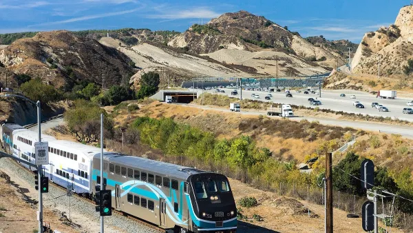
Train Service Expands to Northern Los Angeles County
The added Metrolink service will improve the public transportation system’s accessibility and availability for riders across the Antelope, Santa Clarita, and San Fernando valleys.

National Parks Layoffs Will Cause Communities to Lose Billions
Thousands of essential park workers were laid off this week, just before the busy spring break season.

Retro-silient?: America’s First “Eco-burb,” The Woodlands Turns 50
A master-planned community north of Houston offers lessons on green infrastructure and resilient design, but falls short of its founder’s lofty affordability and walkability goals.

Delivering for America Plan Will Downgrade Mail Service in at Least 49.5 Percent of Zip Codes
Republican and Democrat lawmakers criticize the plan for its disproportionate negative impact on rural communities.

Test News Post 1
This is a summary

Test News Headline 46
Test for the image on the front page.

Balancing Bombs and Butterflies: How the National Guard Protects a Rare Species
The National Guard at Fort Indiantown Gap uses GIS technology and land management strategies to balance military training with conservation efforts, ensuring the survival of the rare eastern regal fritillary butterfly.
Urban Design for Planners 1: Software Tools
This six-course series explores essential urban design concepts using open source software and equips planners with the tools they need to participate fully in the urban design process.
Planning for Universal Design
Learn the tools for implementing Universal Design in planning regulations.
EMC Planning Group, Inc.
Planetizen
Planetizen
Mpact (formerly Rail~Volution)
Great Falls Development Authority, Inc.
HUDs Office of Policy Development and Research
NYU Wagner Graduate School of Public Service