


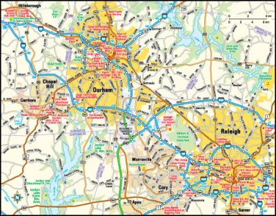
This week residents in the North Carolina Triangle (Raleigh-Durham-Chapel Hill) will provide input on key segments of a future regional light rail system. The project has been analyzed for 15 years, yet the question of whether to build it remains.
NC planners ask: Where to build light rail (and should we still do it?)
This week residents in the North Carolina Triangle (Raleigh-Durham-Chapel Hill) will provide input on key segments of a future regional light rail system. The project has been analyzed for 15 years and is now partially funded, yet the question of whether to build it still remains.
In a series of public workshops, Triangle Transit—lead agency for the proposed 51 mile system—will seek input on specific route configurations, and among the issues are where to locate station areas and maintenance facilities, which neighborhoods to serve, and how to avoid impacting streams and wetlands.
So why are they also asking whether to build the system at all? The system is estimated at $1.34 billion, which may be contribute to lingering doubt. Several Metropolitan Planning Organizations collaborated to help develop Triangle's future transit vision, which includes increased local bus service, expanded regional bus service, and light rail. The system would serve three counties, and almost two dozen cities, as well as several major employment centers, colleges, and the Raleigh-Durham International Airport. The 3000 square mile service area includes 1.5 million residents—approximately 13% of North Carolina's statewide population—and is expected to grow to 2.5 million by 2035.
The regional transit vision relies on new revenue sources, and some local funding is already in place via sales taxes and vehicle registration fees. However a comprehensive, long-term financing strategy with state and federal support has not been secured.
In their workshops this week, Triangle Transit continues to move the project forward, working to resolve key routing questions and asking a question still on everyone's mind: Should we build it?
FULL STORY: Public comments will help fix Orange-Durham light rail route

FTA Rejects North Carolina Commuter Rail Funding
As commuter patterns shift, so too do the transit funding preferences of the federal government.

North Carolina’s Triangle Faces Growing Pains
The region’s rapid growth and high housing costs are prompting a contentious debate over zoning changes that would boost density.
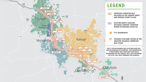
Research Triangle Commuter Rail Studied
A 37-mile commuter rail line under study in North Carolina could connect cities Raleigh, Cary, and Durham in North Carolina, but the system will cost a pretty penny, and it will have to succeed where light rail previously failed.

National Parks Layoffs Will Cause Communities to Lose Billions
Thousands of essential park workers were laid off this week, just before the busy spring break season.

Retro-silient?: America’s First “Eco-burb,” The Woodlands Turns 50
A master-planned community north of Houston offers lessons on green infrastructure and resilient design, but falls short of its founder’s lofty affordability and walkability goals.

Delivering for America Plan Will Downgrade Mail Service in at Least 49.5 Percent of Zip Codes
Republican and Democrat lawmakers criticize the plan for its disproportionate negative impact on rural communities.

Test News Post 1
This is a summary

Test News Headline 46
Test for the image on the front page.

Balancing Bombs and Butterflies: How the National Guard Protects a Rare Species
The National Guard at Fort Indiantown Gap uses GIS technology and land management strategies to balance military training with conservation efforts, ensuring the survival of the rare eastern regal fritillary butterfly.
Urban Design for Planners 1: Software Tools
This six-course series explores essential urban design concepts using open source software and equips planners with the tools they need to participate fully in the urban design process.
Planning for Universal Design
Learn the tools for implementing Universal Design in planning regulations.
EMC Planning Group, Inc.
Planetizen
Planetizen
Mpact (formerly Rail~Volution)
Great Falls Development Authority, Inc.
HUDs Office of Policy Development and Research
NYU Wagner Graduate School of Public Service