


Allison Arieff provides a glimpse to the San Francisco Planning and Urban Research's new exhibit featuring interesting maps of the San Francisco Bay Area.
San Francisco Planning and Urban Research (SPUR) recently unveiled its latest exhibition on maps depicting a wide variety of topics and themes for both San Francisco and the Bay Area region.
Some of the fantastic maps highlighted in Allison Arieff's piece on Medium show the transit networks in the Bay Area through a variety of methods. One of them is the "City from the Valley" map by Stamen Design, showing the different tech bus shuttle routes throughout San Francisco. Stamen Design usually pulls data from online sources, but in this case all of the information was private so they went out and collected it themselves. The map displays the different companies, their stops, and the amount of trips along the lines.
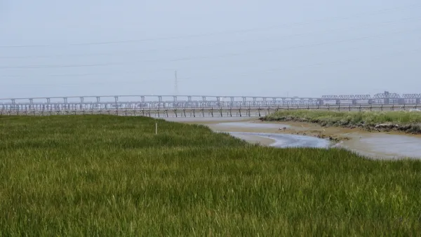
Another excellent map comes from cartographer Brian Stokle and San Francisco institution "Burrito Justice." This set of maps portray the future of the peninsular city with various scenarios of sea level rise. On the more extreme side, a 200-foot rise in sea levels creates the San Francisco Archipelago, with Sutro and Funston Islands, China Beach, and the Bay of Castro. A 25 foot sea rise, which according to the New York Times could be expected in the coming centuries, would flood most of the eastern side of the city, which used to be part of an extensive creek system.
FULL STORY: Urban Cartography

A New Plan for Sea Level Rise in the San Francisco Bay Area
The San Francisco Bay has 400 miles of shoreline, and a dire need for a new approach to dealing with the effects of rising water levels. An estimated $100 billion in potential property damage is at risk.

Bay Area Election Roundup: Wetlands, Housing, Ballot-Box Planning, Sales Tax
A regional measure to tax all property owners in the 9-county Bay Area to adapt to sea level rise passes; S.F. voters support raising the affordable housing bar; Richmond voters reject ballot-box planning; San José approves sales tax increase.
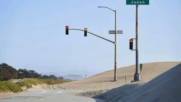
Sea Level Rise Prompts Closure of San Francisco’s Great Highway
The city plans to repurpose a segment of the roadway frequently blocked by blowing sand into a pedestrian plaza.

Analysis: Cybertruck Fatality Rate Far Exceeds That of Ford Pinto
The Tesla Cybertruck was recalled seven times last year.

National Parks Layoffs Will Cause Communities to Lose Billions
Thousands of essential park workers were laid off this week, just before the busy spring break season.

Retro-silient?: America’s First “Eco-burb,” The Woodlands Turns 50
A master-planned community north of Houston offers lessons on green infrastructure and resilient design, but falls short of its founder’s lofty affordability and walkability goals.

Test News Post 1
This is a summary

Analysis: Cybertruck Fatality Rate Far Exceeds That of Ford Pinto
The Tesla Cybertruck was recalled seven times last year.

Test News Headline 46
Test for the image on the front page.
Urban Design for Planners 1: Software Tools
This six-course series explores essential urban design concepts using open source software and equips planners with the tools they need to participate fully in the urban design process.
Planning for Universal Design
Learn the tools for implementing Universal Design in planning regulations.
EMC Planning Group, Inc.
Planetizen
Planetizen
Mpact (formerly Rail~Volution)
Great Falls Development Authority, Inc.
HUDs Office of Policy Development and Research
NYU Wagner Graduate School of Public Service