


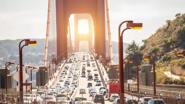
Mirroring a previously reported increase in gasoline consumption in California, the vehicle miles traveled increase over last year is the largest in a decade. The reasons are the same: cheaper gas and an improved economy with more people working.
Vehicle miles traveled (VMT) in California this year are up "2.6 percent from December through November of 2013 according to estimates from the California Department of Transportation [Caltrans]," writes Phillip Reese, database reporter for The Sacramento Bee. "That’s the largest traffic jump since 2003."
To put that leap into perspective, Reese provides data for prior years:
- Highway traffic in the state grew by an average of 3 percent annually between 1973 and 2003
- 1.4 percent between 2004 and 2007, the pre-recession years
- Between 2007 and 2011 – as the economy tanked – highway traffic fell by 3 percent
California's unemployment rate dropped from 12.5 percent at the height of the recession to 7 percent today, "representing almost a million workers, most of whom commute every weekday," writes Reese.
Kent Hymel, a professor of economics at California State University, Northridge, explains the other driving stimulus. "Probably the biggest reason (for the increase in traffic) is the pretty sharp drop in the price of gasoline,” said Hymel, who has published studies [PDF] on the state’s traffic patterns, writes Reese. “It was over $4 a gallon; now, it is down to about $2.60,” adds Hymel.
The increase in driving is expected to have a negative effect on the state's tough greenhouse gas emission reduction goals mandated by AB 32, notwithstanding improved fuel efficiency and an increase in electric vehicles.
Vehicle traffic is “a major contributor” to greenhouse gases, accounting for about 30 percent of the state’s emissions, said Kanok Boriboonsomsin, an associate research engineer at the Center for Environmental Research and Technology at the University of California, Riverside.
Hat tip to The AASHTO Daily Transportation Update
FULL STORY: California highways seeing record traffic, bucking years of decline

San Francisco ‘Best-Performing Metro’ for VMT, Traffic Reduction
The city saw a 13 percent drop in miles driven per capita in the last five years.
When the U.S. Economy Is 'Too Strong' to Spend on Infrastructure
A low unemployment rate means major investments by the federal government could ultimately harm the economy.
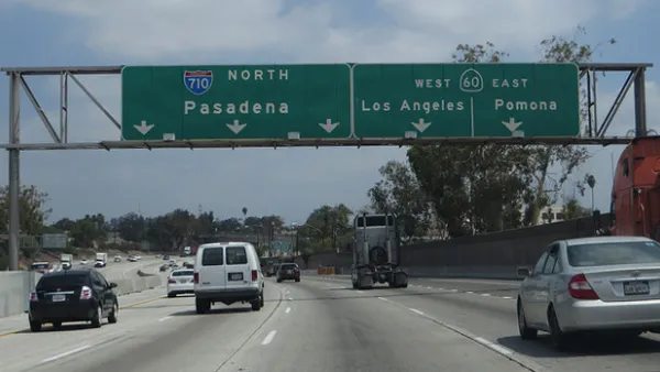
With a 710 Freeway Extension Unlikely, Cities Propose Alternatives
After withdrawing support for a controversial extension of the 710 Freeway, Los Angeles Metro is asking cities for local road improvements to improve traffic flow in its stead.

National Parks Layoffs Will Cause Communities to Lose Billions
Thousands of essential park workers were laid off this week, just before the busy spring break season.

Retro-silient?: America’s First “Eco-burb,” The Woodlands Turns 50
A master-planned community north of Houston offers lessons on green infrastructure and resilient design, but falls short of its founder’s lofty affordability and walkability goals.

Delivering for America Plan Will Downgrade Mail Service in at Least 49.5 Percent of Zip Codes
Republican and Democrat lawmakers criticize the plan for its disproportionate negative impact on rural communities.

Test News Post 1
This is a summary

Test News Headline 46
Test for the image on the front page.

Balancing Bombs and Butterflies: How the National Guard Protects a Rare Species
The National Guard at Fort Indiantown Gap uses GIS technology and land management strategies to balance military training with conservation efforts, ensuring the survival of the rare eastern regal fritillary butterfly.
Urban Design for Planners 1: Software Tools
This six-course series explores essential urban design concepts using open source software and equips planners with the tools they need to participate fully in the urban design process.
Planning for Universal Design
Learn the tools for implementing Universal Design in planning regulations.
EMC Planning Group, Inc.
Planetizen
Planetizen
Mpact (formerly Rail~Volution)
Great Falls Development Authority, Inc.
HUDs Office of Policy Development and Research
NYU Wagner Graduate School of Public Service