


Transport for London has a remarkable span of jurisdiction over transportation in the city—allowing TFL to pursue innovative projects with a relative degree of ease.
Ben Plowden, Surface Transport Director of Strategy and Planning at TFL, elaborated on initiatives for the road network and Thames River in an interview with The Planning Report.
Plowden delves into his experience negotiating between a mix of stakeholders, highlighting efforts to prioritize livability on London streets:
"The real challenge for us is trying to work out the optimal use of the road network overall, and of a particular location at a particular time of day, for the social and economic health of the city. We did a very important piece of work with the key road stakeholders about 18 months ago called the Roads Task Force. At the mayor’s request, we brought all of the people who normally talk to us bilaterally—all of the different lobbies—and underwent a process to come up with a solution for managing and operating the network. That hadn’t been done before! It produced a very interesting conversation. People left the room still thinking their interest should come first, but at least understanding that there are multiple users of the network."
Plowden also elaborates on Mayor Boris Johnson's ability to influence land-use decisions, and how those choices can lead to strategic changes in the transit and road networks:
"To support growth in existing areas and particularly growth in East London and outer London, where the land is, he can direct the activity and the spend by determining where capital investment goes and where operational service goes... The Greater London government was very keen to develop [the Docklands] out to the major financial and growth area. The Canary Wharf Group began the process of developing out Canary Wharf. Initially people got in and out of Canary Wharf primarily through the Docklands Light Railway, along with one main road that connects the City to the Docklands. The DLR was clearly not going to be adequate to sustain the amount of growth planned. So we built the extension of the Jubilee Line out to Canary Wharf and all the way to Stratford, where the Olympics took place subsequently. That unlocked that whole development."
FULL STORY: What Can London Learn from & Teach LA Regarding Urban Transport/Mobility?

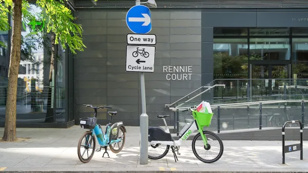
Dockless Bikes Seized as City of London Cracks Down on Parking
Lime and Forest paid £25,000 in fines to retrieve their property and are negotiating solutions with transportation authorities.

Fort Worth Relaunches Bike Share Network
The system, operated by Lyft, is made up of primarily e-bikes.

Indy Bike Share Sees Sharp Growth Thanks to Free Pass Program
A new fleet of e-bikes and free access for Marion County residents are getting more people on bikes.

National Parks Layoffs Will Cause Communities to Lose Billions
Thousands of essential park workers were laid off this week, just before the busy spring break season.

Retro-silient?: America’s First “Eco-burb,” The Woodlands Turns 50
A master-planned community north of Houston offers lessons on green infrastructure and resilient design, but falls short of its founder’s lofty affordability and walkability goals.

Delivering for America Plan Will Downgrade Mail Service in at Least 49.5 Percent of Zip Codes
Republican and Democrat lawmakers criticize the plan for its disproportionate negative impact on rural communities.

Test News Post 1
This is a summary

Test News Headline 46
Test for the image on the front page.

Balancing Bombs and Butterflies: How the National Guard Protects a Rare Species
The National Guard at Fort Indiantown Gap uses GIS technology and land management strategies to balance military training with conservation efforts, ensuring the survival of the rare eastern regal fritillary butterfly.
Urban Design for Planners 1: Software Tools
This six-course series explores essential urban design concepts using open source software and equips planners with the tools they need to participate fully in the urban design process.
Planning for Universal Design
Learn the tools for implementing Universal Design in planning regulations.
EMC Planning Group, Inc.
Planetizen
Planetizen
Mpact (formerly Rail~Volution)
Great Falls Development Authority, Inc.
HUDs Office of Policy Development and Research
NYU Wagner Graduate School of Public Service