


How to generate ideas in planning is a question that many planning students ask. This can seem a mysterious and difficult process. Unfortunately, planning education has not always done a great job of helping students unpack this apparent mystery.

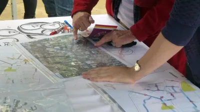
How to generate ideas in planning is a question that many planning students ask. This can seem a mysterious and difficult process. Unfortunately, planning education has not always done a great job of helping students unpack this apparent mystery.
While there are numerous ways planners do in fact generate ideas, in my experience many fall into one of the following categories.
- The black box—a method where the answer comes from a process that is not well described and based on an amalgam of experiences. When Katherine Crewe and I developed a typology of approaches to landscape architecture a few years back, we found that landscape architects well-known for artistic creativity often described their process in this way. However, I expect that most black box approaches supplement one or more of the others below.
- Analysis and synthesis—in this process planners analyze the situation and use that information to synthesize a solution. This is broadly applicable to most planning situations, however it does not give much guidance about the step from analysis to synthesis. Again, I think that many people following this process use one of the following methods to make that step.
- Precedents—in this approach planners look to examples and alter them to fit the situation at hand. This requires some analysis and also knowledge of planning practice. Better planners will have a good sense of such historic cases and in different places with a rich understanding of context. This has the advantage of being tried and true but ideas don’t always transfer well—think of a modernist high rise that does well in affluent parts of New York, in cities like Singapore, or for populations like seniors, but doesn't transfer well to different places and demographic groups.
- Patterns—these are a more abstract form of precedent, looking not at whole environments but at components. The exemplary work is Alexander et al.'s Pattern Language, but some uses of Lynch's The Image of the City would place it in this camp because he identifies patterns like paths and nodes. (There’s a more participatory use of the book, about understanding local perceptions, which is different.) The new urbanists have codified a number of these patterns and use them to generate their developments.
- Similes (and analogies and metaphors)—yet more abstract, an example helps explain this concept. One way landscape architecture faculty sometimes try to inspire students to think more broadly is to ask them to think of a designing a parking lot as a "park for cars." This can create new thinking—for example, parking lot that is planted, cooling, calming. A business improvement district can be seen to make a downtown like a mall (in terms of cleanliness, service, etc.). To think in similes, of course, it helps to understand precedents and have analyzed the sites.
There are likely several other ways people come up with ideas. Within each approach there are many analytical methods, precedents, patterns, and similes making each one complex. However, my point is that generating ideas is a process that can be learned and improved. It isn't a mystery.
I have written about this briefly in "Innovation in Urban Design: Does Research Help?" Journal of Urban Design 12, 3: 461-473. [Abstract]

What Makes a Great Planning Program?
Ann Forsyth, professor of urban planning at the Harvard Graduate School of Design, shares insight into common traits of the best educational programs in planning.
From Grants to Growth: The Critical Role of Funding in Urban Transportation Projects
How cities are taking innovative approaches and adopting technology to develop sustainable, long-term funding sources for transportation infrastructure.

AI’s Growing Threat to Climate Justice
Emerging technologies like AI have great promise for climate innovation, but also a hidden environmental footprint could lead to disproportionate harm to low-income and marginalized communities.

National Parks Layoffs Will Cause Communities to Lose Billions
Thousands of essential park workers were laid off this week, just before the busy spring break season.

Retro-silient?: America’s First “Eco-burb,” The Woodlands Turns 50
A master-planned community north of Houston offers lessons on green infrastructure and resilient design, but falls short of its founder’s lofty affordability and walkability goals.

Delivering for America Plan Will Downgrade Mail Service in at Least 49.5 Percent of Zip Codes
Republican and Democrat lawmakers criticize the plan for its disproportionate negative impact on rural communities.

Test News Post 1
This is a summary

Test News Headline 46
Test for the image on the front page.

Balancing Bombs and Butterflies: How the National Guard Protects a Rare Species
The National Guard at Fort Indiantown Gap uses GIS technology and land management strategies to balance military training with conservation efforts, ensuring the survival of the rare eastern regal fritillary butterfly.
Urban Design for Planners 1: Software Tools
This six-course series explores essential urban design concepts using open source software and equips planners with the tools they need to participate fully in the urban design process.
Planning for Universal Design
Learn the tools for implementing Universal Design in planning regulations.
EMC Planning Group, Inc.
Planetizen
Planetizen
Mpact (formerly Rail~Volution)
Great Falls Development Authority, Inc.
HUDs Office of Policy Development and Research
NYU Wagner Graduate School of Public Service