


A powerful realty group fears tolls will 'marginalize' downtown Montreal, so they propose a regional kilometer-traveled-fee to finance the new Champlain Bridge.
What's so interesting about the KMT Fee option for the Montreal region is that it pits the mileage fee against a bridge toll. On these pages we've seen:
- Debates between raising the federal gas tax and implementing tolls on interstate highways (currently prohibited except for three cases). The American Trucking Associations opposes tolling and supports boosting the federal gas tax to maintain and repair roads and bridges.
- Debates between road usage charges [Oregon's term for a vehicle-miles-traveled (VMT) fee] and raising state gas taxes.
"Downtown Montreal risks being 'marginalized' in favor of the suburbs if tolls are set up, warns [Urban Development Institute of Quebec (UDI)] the largest group of property owners in Quebec, writes Maxime Bergeron of La Presse. "Instead it is proposing implementation of a 'kilometric tax'."
The idea behind the "kilometer tax" to fund the $5 billion replacement Champlain Bridge and corridor is to spread the revenue net among a much wider group of motorists. "(T)he Centre for Interuniversity Research and Analysis on Organizations (CIRANO) had already suggested its establishment in June 2013," adds Bergeron.
"In all scenarios, the kilometer tax is the best way to allocate costs to the greatest number of users, and thus reduce the impact on the cost of commuting to population centers, concluded the research group.
It makes sense in some ways. When only bridges are tolled, there's a financial reason to avoid them—what UDI fears. But when mileage, rather than bridges are tolled, so to speak, there's no reason to avoid them and the downtown destinations that UDI want's suburban motorists to patronize.
Even in Canada, all eyes are on Oregon's program set to launch July 1 to see if the public accept it. Unlike OReGO's flat 1.5 cent-per-mile charge, CIRANO had a more complex charging system in mind:
Basically, it would be to price movements of all motorists based on the employee trip, the number of kilometers traveled, time of day and displacement. The charge would be calculated by providing each vehicle with a detection unit, "a kind of second GPS" said Mario Lefebvre, CEO of UDI. [These units - see Azuga image in recent post on Oregon program, are technically called dongles that attach to the vehicle's OBD II system.]
Ottawa (Canada's center of government) plans to toll the replacement for the aging Champlain Bridge that "crosses the Saint Lawrence River and Saint Lawrence Seaway, connecting the Montreal boroughs of Verdun and Le Sud-Ouest to Brossard on the South Shore," according to Wikipedia.
However, even the relatively low price, "estimated at less than $3 per trip, has raised the ire of the public, as well as local and provincial politicians," wrote
Correspondent's notes: Hat tip to Ben Adler of Grist who spotted the article in Sustainable Cities Collective, "an editorially independent, moderated community for leaders of major metropolitan areas, urban planning and sustainability professionals." They had reprinted the article from an April 30 post by Bora Mici, also a Planetizen correspondent, in their partner publication, Global Site Plans.
I feel quite certain that the article was originally printed in La Presse on April 8.
FULL STORY: Champlain Bridge: HGV property against the toll [April 8]

First Span of Governor Mario M. Cuomo Bridge Opened Last Night
The westbound 3.1-mile span from Tarrytown across the Hudson River to South Nyack in Rockland County stands adjacent to the 62-year-old Tappan Zee Bridge that will be dismantled next year. The new $3.9 billion bridge was built on-time and on-budget.
Toll Increase Pushes Commuters Into Transit
The Port Authority of N.Y & N.J toll increase on Hudson River bridges and tunnels causes a 4% drop in vehicles and 3.7% increase in PATH train ridership despite fare increase; 3/5% increase in E-Z pass usage, and 20% increase in toll revenue.
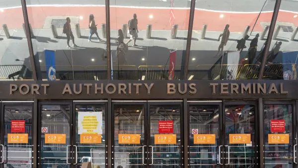
NYC Secures Funding for Midtown Bus Terminal Replacement
The aging Manhattan transit terminal, the world’s busiest, will receive a $10 billion revamp and expansion.

National Parks Layoffs Will Cause Communities to Lose Billions
Thousands of essential park workers were laid off this week, just before the busy spring break season.

Retro-silient?: America’s First “Eco-burb,” The Woodlands Turns 50
A master-planned community north of Houston offers lessons on green infrastructure and resilient design, but falls short of its founder’s lofty affordability and walkability goals.

Delivering for America Plan Will Downgrade Mail Service in at Least 49.5 Percent of Zip Codes
Republican and Democrat lawmakers criticize the plan for its disproportionate negative impact on rural communities.

Test News Post 1
This is a summary

Test News Headline 46
Test for the image on the front page.

Balancing Bombs and Butterflies: How the National Guard Protects a Rare Species
The National Guard at Fort Indiantown Gap uses GIS technology and land management strategies to balance military training with conservation efforts, ensuring the survival of the rare eastern regal fritillary butterfly.
Urban Design for Planners 1: Software Tools
This six-course series explores essential urban design concepts using open source software and equips planners with the tools they need to participate fully in the urban design process.
Planning for Universal Design
Learn the tools for implementing Universal Design in planning regulations.
EMC Planning Group, Inc.
Planetizen
Planetizen
Mpact (formerly Rail~Volution)
Great Falls Development Authority, Inc.
HUDs Office of Policy Development and Research
NYU Wagner Graduate School of Public Service