


Richard Florida discusses a study comparing the neighborhoods that house "creative" industries. Science and tech tends to favor low-density office parks, while arts and cultural industries prefer mixed-use urban districts.
In a piece for CityLab, Richard Florida reports on a study by Greg Spencer into "creative" and "innovative" urban districts. From research covering Canada's major metropolitan regions, two distinct land use typologies emerge: science-based and creative.
For the study, "Spencer defines high-tech or 'science-based' industries as spanning computer, software, pharmaceuticals and medicine, as well as research and development, while 'creative' industries include film and video, music, radio and television, and design, as well as independent artists, writers and performers."
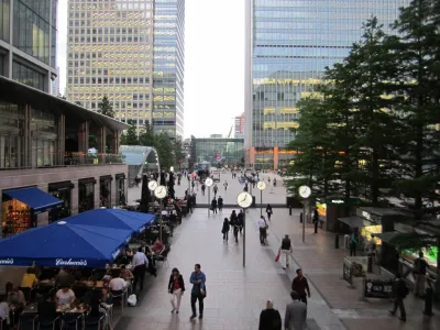
Findings confirmed that "the science-based firms and industries are out in the suburbs, along highway interchanges, and in newer, low density suburban campuses. The creative industry locations are much more urban, dense, closer to the core of the city, walkable, mixed-use and often served by public transit."
Florida discusses theories about why land use patterns fall into these two camps. Reasons include:
- Tech firms tend to be larger than creative firms, both in terms of employees and square footage
- Social networks are more important in the creative fields
- Creative firms are willing to pay higher rents to be close to similar businesses
FULL STORY: What a Creative Neighborhood Looks Like

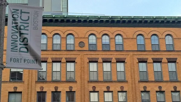
Status Report: the Rise of Innovation Districts
Last year, the "innovation district" rose to prominence as a way to describe urban knowledge economy epicenters. This report from Bruce Katz and Brookings describes how the phenomenon continues to evolve.
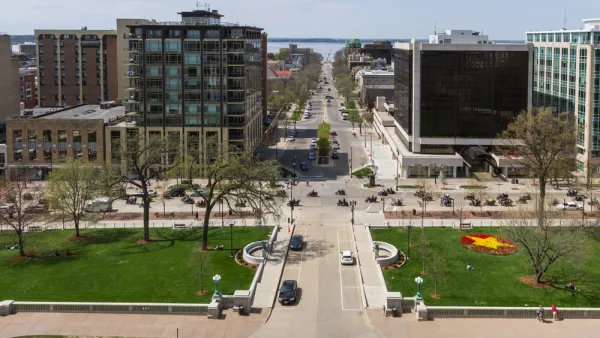
'Growth Centers' for a More Even Distribution of Tech Industry Growth
A few regions have hoarded the growth of the tech innovation economy. A Brookings paper argues that Congress can help distribute tech innovation in growth centers around the Heartland of the United States.

'The New Urban Crisis' and the High Line
A PBS NewsHour two-fer: an interview of urbanologist Richard Florida conducted in a walking tour of New York's famed High Line in the gentrifying West Chelsea neighborhood, a fitting backdrop for his new book, "The New Urban Crisis."

National Parks Layoffs Will Cause Communities to Lose Billions
Thousands of essential park workers were laid off this week, just before the busy spring break season.

Retro-silient?: America’s First “Eco-burb,” The Woodlands Turns 50
A master-planned community north of Houston offers lessons on green infrastructure and resilient design, but falls short of its founder’s lofty affordability and walkability goals.

Delivering for America Plan Will Downgrade Mail Service in at Least 49.5 Percent of Zip Codes
Republican and Democrat lawmakers criticize the plan for its disproportionate negative impact on rural communities.

Test News Post 1
This is a summary

Test News Headline 46
Test for the image on the front page.

Balancing Bombs and Butterflies: How the National Guard Protects a Rare Species
The National Guard at Fort Indiantown Gap uses GIS technology and land management strategies to balance military training with conservation efforts, ensuring the survival of the rare eastern regal fritillary butterfly.
Urban Design for Planners 1: Software Tools
This six-course series explores essential urban design concepts using open source software and equips planners with the tools they need to participate fully in the urban design process.
Planning for Universal Design
Learn the tools for implementing Universal Design in planning regulations.
EMC Planning Group, Inc.
Planetizen
Planetizen
Mpact (formerly Rail~Volution)
Great Falls Development Authority, Inc.
HUDs Office of Policy Development and Research
NYU Wagner Graduate School of Public Service