


Many places are statistically diverse, but their inhabits can be worlds apart. A local perspective (and finer data) is needed to fully appreciate how different races and classes inhabit a neighborhood.
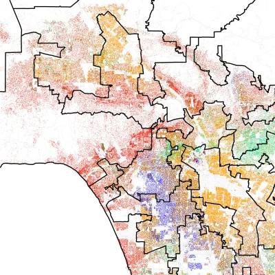
While the 98118 zip code near Seattle gained some fame in 2010 for its statistical diversity, University of Washington researchers Ryan Gabriel and Tim Thomas weren't so sure. They decided to take a closer look. Said Gabriel, "'It's a highly-diverse city in some ways, but as you kind of walk the city, you experience a real sense of separation between racial groups and class levels as well.'"
There can be cultural and economic gulfs between communities only minutes apart. From the article: "In Columbia City, for example, the researchers found the west side of the tract had lots of immigrant markets and fast food restaurants. On the predominantly white side of the tract near the bay were five-star restaurants serving $60 entrees."
In that example, even a physical barrier separated white from black, rich from poor. "A steep north-south ridge that can't be crossed by foot divides the tract. More than 78 percent of black residents life on the west side of the ridge, where most homes are run down and few new homes exist [...]"
The researchers found similar results in cities across the United States. The racial dot map, a version of which appears in the article, is an invaluable tool to appreciate finer degrees of segregation. The map uses 2010 census data and includes Hawaii and Alaska.
FULL STORY: When “diverse” neighborhoods are more segregated than they appear


How Cities Can Avoid Perpetuating Segregation
Residents of big cities, known as the ‘melting pots’ of America, have fewer interactions with people outside their socioeconomic group than those in smaller communities, according to new research.
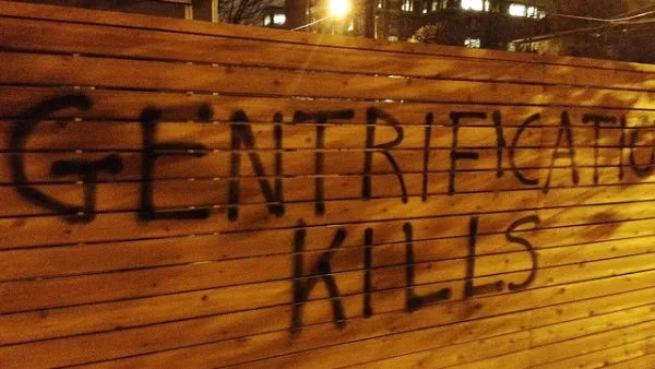
What We Really Mean When We Say Gentrification
The focus on gentrifying communities has, in many cases, eclipsed the similar problems facing more stagnant neighborhoods.
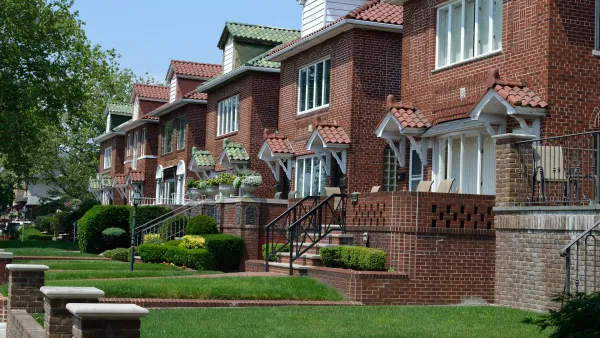
What Trump Gets Wrong About America’s Suburbs
The Trump administration’s talk about protecting the suburbs is based on misrepresentations of who really lives in suburbs and what these communities need.

National Parks Layoffs Will Cause Communities to Lose Billions
Thousands of essential park workers were laid off this week, just before the busy spring break season.

Retro-silient?: America’s First “Eco-burb,” The Woodlands Turns 50
A master-planned community north of Houston offers lessons on green infrastructure and resilient design, but falls short of its founder’s lofty affordability and walkability goals.

Delivering for America Plan Will Downgrade Mail Service in at Least 49.5 Percent of Zip Codes
Republican and Democrat lawmakers criticize the plan for its disproportionate negative impact on rural communities.

Test News Post 1
This is a summary

Test News Headline 46
Test for the image on the front page.

Balancing Bombs and Butterflies: How the National Guard Protects a Rare Species
The National Guard at Fort Indiantown Gap uses GIS technology and land management strategies to balance military training with conservation efforts, ensuring the survival of the rare eastern regal fritillary butterfly.
Urban Design for Planners 1: Software Tools
This six-course series explores essential urban design concepts using open source software and equips planners with the tools they need to participate fully in the urban design process.
Planning for Universal Design
Learn the tools for implementing Universal Design in planning regulations.
EMC Planning Group, Inc.
Planetizen
Planetizen
Mpact (formerly Rail~Volution)
Great Falls Development Authority, Inc.
HUDs Office of Policy Development and Research
NYU Wagner Graduate School of Public Service