


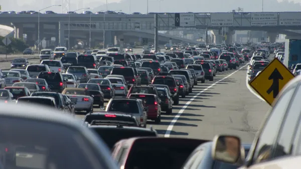
In the ongoing quest to better measure the use of streets by all modes—a new tool could be a game changer for transportation engineers, planners, and advocates alike.
Tanya Snyder reports: "A new digital tool called Placemeter aims to measure streets at a much more fine-grained level, analyzing a variety of different aspects of movement in an urban environment."
"Placemeter’s software extracts information from video of streets — it can measure the movement of vehicles, bicyclists, and pedestrians and then tell you about things like the incidence of speeding or the foot traffic for a specific storefront. Cities are finding lots of interesting ways to use it — but it’s not just for bureaucrats. The people behind Placemeter think it will be very useful for advocates too."
The article includes an interview with Alexandre Winter and Florent Peyre, founders of Placemeter, who explain the method of the new tool and its many possible applications. For additional introduction to Placemeter, there's the video found below.
Placemeter Algorithms Output from Placemeter on Vimeo.
FULL STORY: Can a New Way to Measure Streets Help Advocates Tame Speeding?

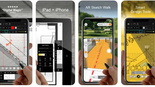
Best Apps for Urban Planning in 2022
Mobile apps continue to redefine the practices of planning—urban planning, regional planning, transportation planning, community planning, and rural planning included.

The Right Planning Consultant Could Make All of the Difference
Between DART service optimization and deciding the fate of I-345, Dallas has big of decisions to make. The right consultant, who understands accurate framing of planning issues, could help choose a route that best serves Dallasites.
Failing to Account for Induced Traffic, Even When the Public Demands It
Induced traffic occurs when new highway capacity speeds up traffic, allowing travelers to drive further, increasing sprawl. A review of major highway project plans finds that most fail to accurately account for induced travel effects.

National Parks Layoffs Will Cause Communities to Lose Billions
Thousands of essential park workers were laid off this week, just before the busy spring break season.

Retro-silient?: America’s First “Eco-burb,” The Woodlands Turns 50
A master-planned community north of Houston offers lessons on green infrastructure and resilient design, but falls short of its founder’s lofty affordability and walkability goals.

Delivering for America Plan Will Downgrade Mail Service in at Least 49.5 Percent of Zip Codes
Republican and Democrat lawmakers criticize the plan for its disproportionate negative impact on rural communities.

Test News Post 1
This is a summary

Test News Headline 46
Test for the image on the front page.

Balancing Bombs and Butterflies: How the National Guard Protects a Rare Species
The National Guard at Fort Indiantown Gap uses GIS technology and land management strategies to balance military training with conservation efforts, ensuring the survival of the rare eastern regal fritillary butterfly.
Urban Design for Planners 1: Software Tools
This six-course series explores essential urban design concepts using open source software and equips planners with the tools they need to participate fully in the urban design process.
Planning for Universal Design
Learn the tools for implementing Universal Design in planning regulations.
EMC Planning Group, Inc.
Planetizen
Planetizen
Mpact (formerly Rail~Volution)
Great Falls Development Authority, Inc.
HUDs Office of Policy Development and Research
NYU Wagner Graduate School of Public Service