


Interested in finding the road less traveled by? Walkonomics has launched in seven cities around the globe.
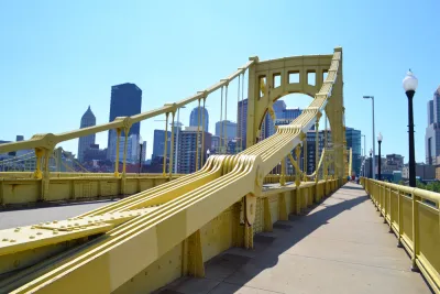
"Those interested in finding the most beautiful, walkable route to their destination can now try Walkonomics," reports Liz Camuti. " The app, created by United Kingdom programmer Adam Davies, allows users to find more beautiful paths through seven cities across the globe using both open and crowd-sourced city data."
The app is available for Android and iOS, and works in Central London, Paris, New York, San Francisco, Toronto, Buenos Aires, and Glasgow. To help users chose the most pedestrian-friendly and beautiful routes, "[t]he app provides star rankings for eight different categories of pedestrian-friendliness: road safety; easy to cross; pavement/sidewalk; hilliness; navigation; fear of crime; 'smart & beautiful;' and 'fun & relaxing.'"
Camuti also explains more about how the app works: "These ratings are generated from open data including street widths, traffic levels, crime statistics, pedestrian accidents, and even how many trees are on each street. Visitors and residents can provide additional ratings for each of these criteria as they walk down streets in their neighborhood, as well as geo-referenced photos." Camuti also provides a review of the app's user experience.
FULL STORY: Walkonomics: What Makes the Best Route?

Airbnb Draws Tourists Off the Beaten Path
Airbnb connects travelers from around the world to unique rentable spaces. With the recent launch of a "Neighborhoods" feature, Airbnb has the potential to redirect tourist spending to often overlooked areas.
What Today's Cities Will Look Like in the Future
Imagining cities of the future can bring about some pretty wild predictions. But when they're visions of existing cities, these futuristic predictions can be almost realistic.
Where Pandemic Bike Improvements Won Out
While some cities are reverting back to pre-pandemic street configurations, others are taking advantage of the momentum for bike and pedestrian infrastructure to make pandemic-era projects permanent.

National Parks Layoffs Will Cause Communities to Lose Billions
Thousands of essential park workers were laid off this week, just before the busy spring break season.

Retro-silient?: America’s First “Eco-burb,” The Woodlands Turns 50
A master-planned community north of Houston offers lessons on green infrastructure and resilient design, but falls short of its founder’s lofty affordability and walkability goals.

Delivering for America Plan Will Downgrade Mail Service in at Least 49.5 Percent of Zip Codes
Republican and Democrat lawmakers criticize the plan for its disproportionate negative impact on rural communities.

Test News Post 1
This is a summary

Test News Headline 46
Test for the image on the front page.

Balancing Bombs and Butterflies: How the National Guard Protects a Rare Species
The National Guard at Fort Indiantown Gap uses GIS technology and land management strategies to balance military training with conservation efforts, ensuring the survival of the rare eastern regal fritillary butterfly.
Urban Design for Planners 1: Software Tools
This six-course series explores essential urban design concepts using open source software and equips planners with the tools they need to participate fully in the urban design process.
Planning for Universal Design
Learn the tools for implementing Universal Design in planning regulations.
EMC Planning Group, Inc.
Planetizen
Planetizen
Mpact (formerly Rail~Volution)
Great Falls Development Authority, Inc.
HUDs Office of Policy Development and Research
NYU Wagner Graduate School of Public Service