


Open data can be a powerful tool for illustrating the risks to public safety that will have to be overcome as more cities adopt Vision Zero initiatives.
"Montgomery County now publishes detailed traffic violation data, which goes online daily here," according to a post by Jacob Mason. "This data allows anyone to see where and when the police are issuing citations, and to whom." Mason used that data, for instance, to create a map of speeding violations covering June 1 through August 16. On the map, the size of the bubbles representing violations even correspond to how far over the speed limit the driver was traveling when cited.
With the map as an illustration, Mason argues for more and better open data projects by local governments. Mason pays specific attention to the Washington, D.C.'s region, which he says had made progress but can still improve.
FULL STORY: When governments make road data public, anyone can help make roads safer


Let’s End Traffic Stops
The technology to make traffic enforcement obsolete is becoming available. But in the U.S. willing to use it?
When it Comes to Road Diets, Evidence Doesn't Matter
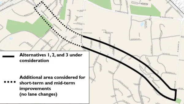
Drivers are a powerful enough lobby to overcome all evidence of the need to redesign streets for safety. Examples from Maryland and Virginia provide the latest case studies in Vision Zero futility.
Speeding Camera Issues 6,000 Tickets in a Day—Is it Unfair?
After issuing 6,000 speeding tickets in one day, a speeding camera in Sheepshead Bay in New York City has already influenced driving habits. But some in the community are calling the location of the cameras a trap.

Analysis: Cybertruck Fatality Rate Far Exceeds That of Ford Pinto
The Tesla Cybertruck was recalled seven times last year.

National Parks Layoffs Will Cause Communities to Lose Billions
Thousands of essential park workers were laid off this week, just before the busy spring break season.

Retro-silient?: America’s First “Eco-burb,” The Woodlands Turns 50
A master-planned community north of Houston offers lessons on green infrastructure and resilient design, but falls short of its founder’s lofty affordability and walkability goals.

Test News Post 1
This is a summary

Analysis: Cybertruck Fatality Rate Far Exceeds That of Ford Pinto
The Tesla Cybertruck was recalled seven times last year.

Test News Headline 46
Test for the image on the front page.
Urban Design for Planners 1: Software Tools
This six-course series explores essential urban design concepts using open source software and equips planners with the tools they need to participate fully in the urban design process.
Planning for Universal Design
Learn the tools for implementing Universal Design in planning regulations.
EMC Planning Group, Inc.
Planetizen
Planetizen
Mpact (formerly Rail~Volution)
Great Falls Development Authority, Inc.
HUDs Office of Policy Development and Research
NYU Wagner Graduate School of Public Service