


Where pedestrian-only streets have failed to draw business, the problem may be a failure to think big enough.
.png)
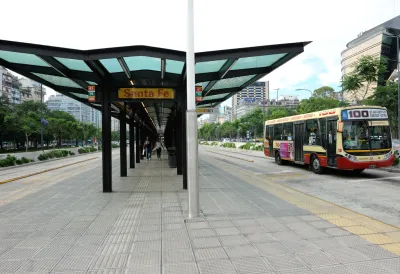
The city of Buenos Aires has transformed a 20-lane congested highway into an 80-block multi-modal downtown avenue with dedicated bus lanes, plenty of space for walkers, and green space. Daily commute times have been cut in half for 200,000 bus passengers. Car access to these renovated streets is limited to local residents with parking passes. The speed limit for local car traffic is 10 km.
The Sustainable Mobility Plan for the city of nearly 3 million residents and 4 million commuters and tourists "rethinks the value and use of public spaces for citizens, not simply as areas reserved for transport services and connections, but as areas of mobility for citizens," according to the state's website.
Robert Everett-Green argues that similar attempts to pedestrianize streets in Canada have failed because they assumed that only highly commercial/retail zones would be appropriate for pedestrianization. A look at the Buenos Aires experience immediately exposes the weakness of most North American attempts at pedestrianization: that they are too narrowly focused on a few blocks of one street, with little thought given to the broader ecology of public space and transport," he writes. The head of transportation in Buenos Aires, Guillermo Dietrich "says the city was not swayed by the conventional wisdom that pedestrian zones only work in strong retail and nightlife zones," according to Everett-Green.
Everett-Green points out that pedestrian-only zones–such as a four-block stretch of Ottawa's Sparks Street–are too limited in scope. Adding planter boxes to a small zone where more than half the streetscape is populated by public works buildings is an insufficient strategy for appealing to pedestrians, he writes. In contrast, another 20 blocks are planned for the pedestrian-friendly zone on Avenida 9 de Julio in Buenos Aires, and spaces formerly used by parking lots are being repurposed for retail and residential development, suggesting that transit innovation can spur mixed use development.
FULL STORY: Walk this way: In Buenos Aires, pedestrian streets are the way of the future


Rick Steves on Walkability Lessons From Europe
Many of Europe’s pedestrian-friendly, transit-rich cities weren’t always that way.
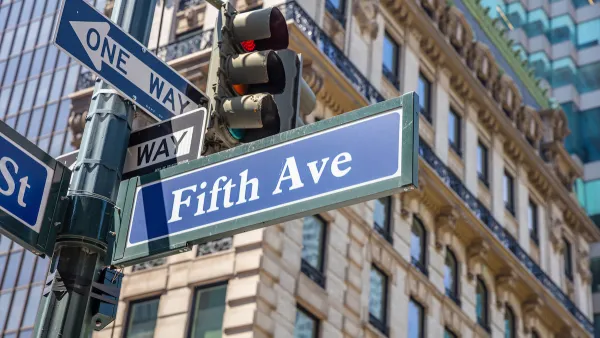
What Will Become of Fifth Avenue?
Visitors to the iconic shopping street overwhelmingly arrive by walking, transit, or bike. Why are bike and pedestrian infrastructure improvement lagging so far behind another famous NYC street, Broadway?
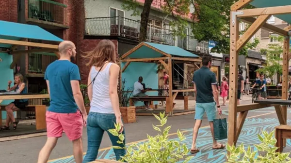
Car-Free Montreal Street Hailed as Success
A summer pedestrianization project is widely popular with residents and local businesses.

National Parks Layoffs Will Cause Communities to Lose Billions
Thousands of essential park workers were laid off this week, just before the busy spring break season.

Retro-silient?: America’s First “Eco-burb,” The Woodlands Turns 50
A master-planned community north of Houston offers lessons on green infrastructure and resilient design, but falls short of its founder’s lofty affordability and walkability goals.

Delivering for America Plan Will Downgrade Mail Service in at Least 49.5 Percent of Zip Codes
Republican and Democrat lawmakers criticize the plan for its disproportionate negative impact on rural communities.

Test News Post 1
This is a summary

Test News Headline 46
Test for the image on the front page.

Balancing Bombs and Butterflies: How the National Guard Protects a Rare Species
The National Guard at Fort Indiantown Gap uses GIS technology and land management strategies to balance military training with conservation efforts, ensuring the survival of the rare eastern regal fritillary butterfly.
Urban Design for Planners 1: Software Tools
This six-course series explores essential urban design concepts using open source software and equips planners with the tools they need to participate fully in the urban design process.
Planning for Universal Design
Learn the tools for implementing Universal Design in planning regulations.
EMC Planning Group, Inc.
Planetizen
Planetizen
Mpact (formerly Rail~Volution)
Great Falls Development Authority, Inc.
HUDs Office of Policy Development and Research
NYU Wagner Graduate School of Public Service