


The tragedy on Livingston Avenue could have been avoided, but the city of New Brunswick's concern was with motorists—not pedestrians.
A new study finds that metro areas can reduce traffic crashes by 19 percent on busy arterial streets by imposing a road diet. A road diet reduces the number of lanes dedicated to car traffic, widening the space (and hence improving safety) for cyclists, pedestrians, and street parking. It is an antidote to the previously popular policy of widening arterial roads to accommodate increasing numbers of commuters.
"The original thinking held that wider roads meant better traffic flows, especially at rush-hour, but new lanes also attracted new traffic, and outside the peak periods you'd end up with lots of wasted road space," writes Eric Jaffe.
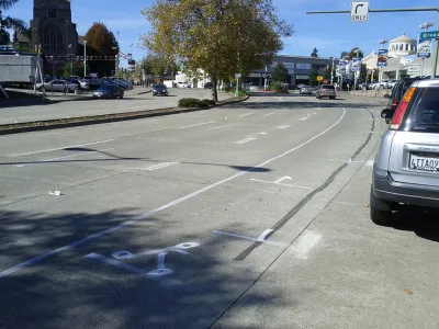
The case study is a cost-benefit analysis of Livingston Ave in New Brunswick, N.J., "an oversized arterial corridor accessing the center of the city." It comes on the heels of a traffic collision involving three students, who were seriously injured as a result. New Brunswick is home to Rutgers University, and the four-lane street has thousands of rush-hour commuters as well as many pedestrians. Drivers mostly ignore the 25 mph speed limit.
"What makes the situation in New Brunswick so much more regrettable is that city leaders knew about the safety hazards on Livingston Avenue but hesitated to change traffic patterns for fear of offending drivers," Jaffe laments.
Jaffe provides a nice graphic illustrating the simple and cheap road diet alterations proposed. According to the study, the costs are mostly political; research demonstrated that the level of service for drivers increased only modestly after a road diet. Jaffe finds: "All told, the traffic impacts amounted to two or three minutes of total delay and maybe one or two more minutes of travel time, depending on morning or evening rush hour and the precise configuration of the road diet[.]"
FULL STORY: The Benefits of Slower Traffic, Measured in Money and Lives

Rick Steves on Walkability Lessons From Europe
Many of Europe’s pedestrian-friendly, transit-rich cities weren’t always that way.
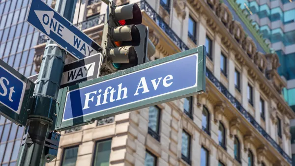
What Will Become of Fifth Avenue?
Visitors to the iconic shopping street overwhelmingly arrive by walking, transit, or bike. Why are bike and pedestrian infrastructure improvement lagging so far behind another famous NYC street, Broadway?
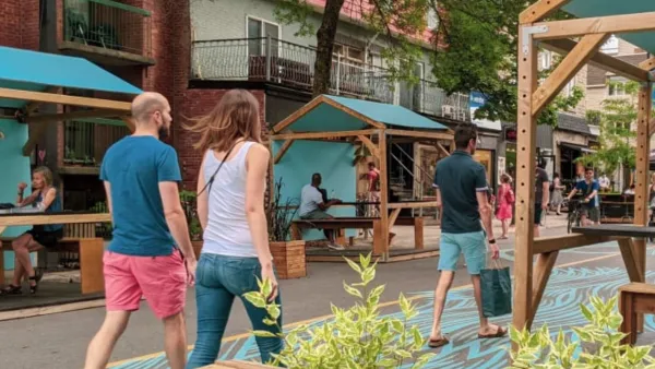
Car-Free Montreal Street Hailed as Success
A summer pedestrianization project is widely popular with residents and local businesses.

National Parks Layoffs Will Cause Communities to Lose Billions
Thousands of essential park workers were laid off this week, just before the busy spring break season.

Retro-silient?: America’s First “Eco-burb,” The Woodlands Turns 50
A master-planned community north of Houston offers lessons on green infrastructure and resilient design, but falls short of its founder’s lofty affordability and walkability goals.

Delivering for America Plan Will Downgrade Mail Service in at Least 49.5 Percent of Zip Codes
Republican and Democrat lawmakers criticize the plan for its disproportionate negative impact on rural communities.

Test News Post 1
This is a summary

Test News Headline 46
Test for the image on the front page.

Balancing Bombs and Butterflies: How the National Guard Protects a Rare Species
The National Guard at Fort Indiantown Gap uses GIS technology and land management strategies to balance military training with conservation efforts, ensuring the survival of the rare eastern regal fritillary butterfly.
Urban Design for Planners 1: Software Tools
This six-course series explores essential urban design concepts using open source software and equips planners with the tools they need to participate fully in the urban design process.
Planning for Universal Design
Learn the tools for implementing Universal Design in planning regulations.
EMC Planning Group, Inc.
Planetizen
Planetizen
Mpact (formerly Rail~Volution)
Great Falls Development Authority, Inc.
HUDs Office of Policy Development and Research
NYU Wagner Graduate School of Public Service