


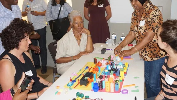
The process of building tactile models of neighborhoods as tools for planning outreach just got an upgrade with a high-tech, interactive Lego model built for the Boston area.
"MIT researchers unveiled something earlier this month that will please toddlers and serious urban planners alike," reports Linda Poon. "It’s a model of Dudley Square—a neighborhood in the greater Boston area—about the size of a kitchen table. The roads, sidewalks, bus stations, and buildings are all made out of Lego blocks. Wee Lego figures represent pedestrians. Laid over it all is a computer-generated projection of the actual neighborhood, filling in the details of current green space and traffic in Dudley Square."
The model is a collaborative project between the MIT Department of Urban Studies and Planning, the Changing Places group at the MIT Media Lab, and the Barr Foundation, according to Poon, designed to test ideas for a bus rapid transit system in the city.
The Lego model is only one of three interactive components, each at different scales, to the project. Also included are a second 3-D model, also made of Legos, of a Boston street, "and a touchscreen interface to illustrate the potential effects of different plans on a regional scale—such as how changes to public transit might affect people’s access to jobs."
Moving the Lego pieces around on the models produces feedback about how those changes would play out through the system.
FULL STORY: Using Legos as a Legitimate Urban Planning Tool

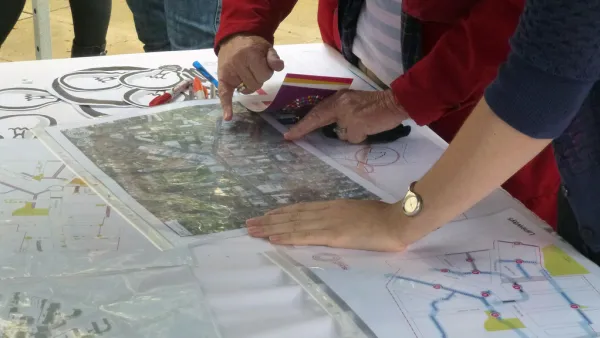
Empowered Through Design: How a Purposefully Rudimentary Activity Sparks the Imagination
Memory can be an intensely powerful tool when planning for the future.
Why Aren’t There More Planners?
Planning can be a great career for socially conscious individuals, but university programs are struggling to attract new students to the field. A trio of academics are raising awareness about the field through community activation.

New Public Hearing Requirements Delay Completion of Reston’s New Comprehensive Plan
One of the country’s most prominent master-planned communities has spent several years working on an a comprehensive plan update. The plan will have to wait a little longer as the Fairfax County, Virginia community adjusts to new state laws.

National Parks Layoffs Will Cause Communities to Lose Billions
Thousands of essential park workers were laid off this week, just before the busy spring break season.

Retro-silient?: America’s First “Eco-burb,” The Woodlands Turns 50
A master-planned community north of Houston offers lessons on green infrastructure and resilient design, but falls short of its founder’s lofty affordability and walkability goals.

Delivering for America Plan Will Downgrade Mail Service in at Least 49.5 Percent of Zip Codes
Republican and Democrat lawmakers criticize the plan for its disproportionate negative impact on rural communities.

Test News Post 1
This is a summary

Test News Headline 46
Test for the image on the front page.

Balancing Bombs and Butterflies: How the National Guard Protects a Rare Species
The National Guard at Fort Indiantown Gap uses GIS technology and land management strategies to balance military training with conservation efforts, ensuring the survival of the rare eastern regal fritillary butterfly.
Urban Design for Planners 1: Software Tools
This six-course series explores essential urban design concepts using open source software and equips planners with the tools they need to participate fully in the urban design process.
Planning for Universal Design
Learn the tools for implementing Universal Design in planning regulations.
EMC Planning Group, Inc.
Planetizen
Planetizen
Mpact (formerly Rail~Volution)
Great Falls Development Authority, Inc.
HUDs Office of Policy Development and Research
NYU Wagner Graduate School of Public Service