


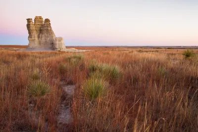
A map-making effort by The Washington Post's Wonkblog puts the Western United States' population, or lack thereof, in perspective.
"I don't know about you, but I'm a sucker for those maps that show the crazy geographic concentration of things like wealth and population," begins a recent post. He clearly wasn't talking to us at Planetizen because then he would know that we are a sucker for those maps that show crazy geographic concentration of things like wealth and population.
The map Ingraham shared with his audience on this occasion is meant to illustrate the "jaw-dropping emptiness of America." Sourced from Reddit, the original map shows "the enormous chunk of land where only 1 percent of the population lives." Ingraham updated the map for a bit more legibility and with the 2014 population numbers from the U.S. Census.
Ingraham provides a few different ways of putting the data shown on the map in perspective, in addition to offering one very specific mark of distinction:
The least-populated place in the United States is Alaska's Yukon-Koyukuk Census Area. At over 145,000 square miles, it's larger than New York, Pennsylvania, Maryland and Virginia -- combined. But it's home to only 5,547 people, for a population density of fewer than 4 people every 100 miles.
FULL STORY: Look at the jaw-dropping emptiness of America

Facebook AI Maps Population Density
Facebook expects to release its worldwide maps of human density in the coming months—potential applications will likely be somewhere on the spectrum between humanitarian and commercial.

DOT Memo Directs Transportation Funding to Communities With Higher Marriage and Birth Rates, Compliance with Immigration Officials and No Mask Mandates
The memo ties immigration enforcement to federal funding and prohibits mask or vaccine mandates.

Maps: How Much of Your City is Parking?
The percentage of land dedicated to parking in the central districts of major U.S. cities ranges from 4 percent to as much as 42 percent.

National Parks Layoffs Will Cause Communities to Lose Billions
Thousands of essential park workers were laid off this week, just before the busy spring break season.

Retro-silient?: America’s First “Eco-burb,” The Woodlands Turns 50
A master-planned community north of Houston offers lessons on green infrastructure and resilient design, but falls short of its founder’s lofty affordability and walkability goals.

Delivering for America Plan Will Downgrade Mail Service in at Least 49.5 Percent of Zip Codes
Republican and Democrat lawmakers criticize the plan for its disproportionate negative impact on rural communities.

Test News Post 1
This is a summary

Test News Headline 46
Test for the image on the front page.

Balancing Bombs and Butterflies: How the National Guard Protects a Rare Species
The National Guard at Fort Indiantown Gap uses GIS technology and land management strategies to balance military training with conservation efforts, ensuring the survival of the rare eastern regal fritillary butterfly.
Urban Design for Planners 1: Software Tools
This six-course series explores essential urban design concepts using open source software and equips planners with the tools they need to participate fully in the urban design process.
Planning for Universal Design
Learn the tools for implementing Universal Design in planning regulations.
EMC Planning Group, Inc.
Planetizen
Planetizen
Mpact (formerly Rail~Volution)
Great Falls Development Authority, Inc.
HUDs Office of Policy Development and Research
NYU Wagner Graduate School of Public Service